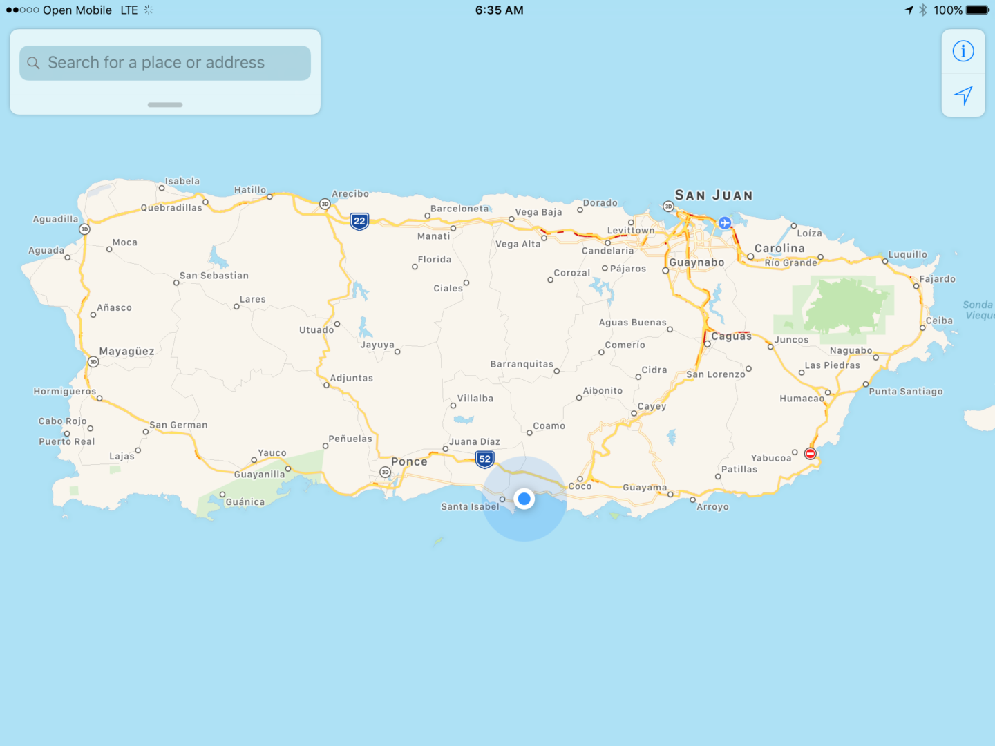
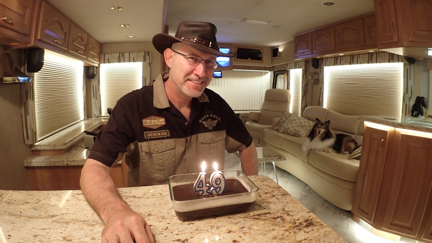
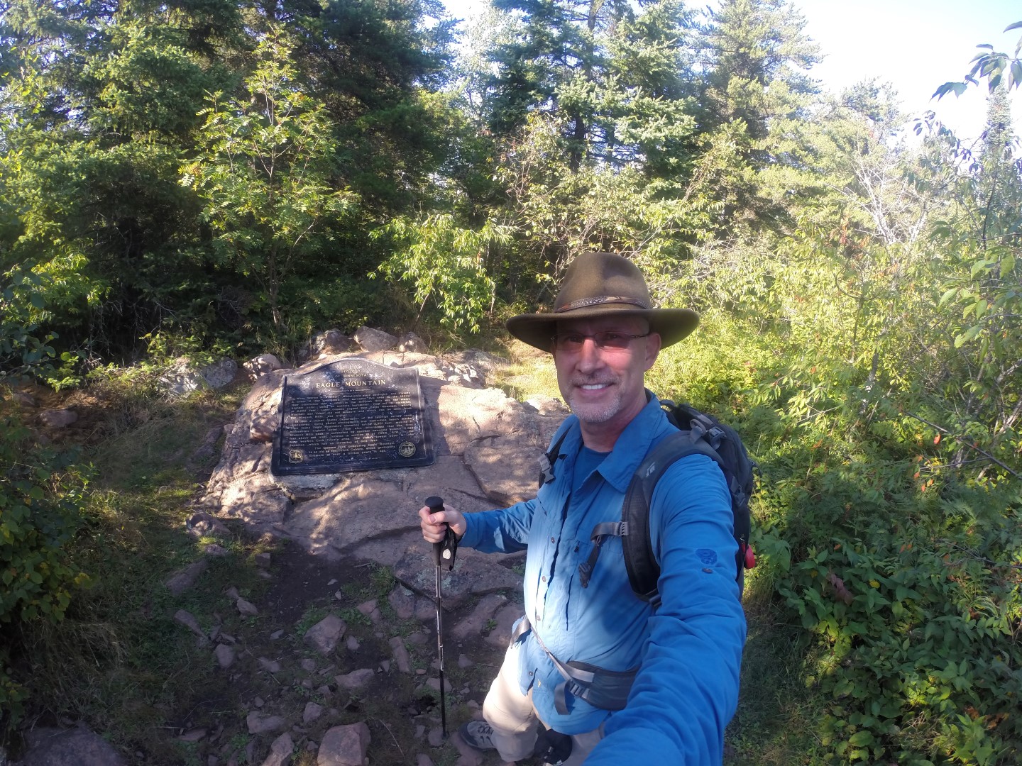
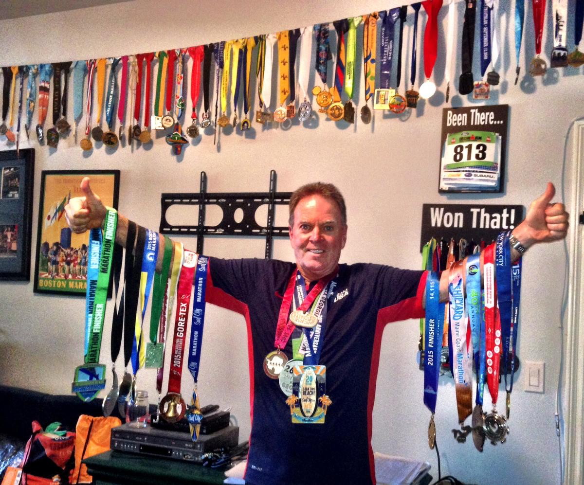
On my 50th birthday, at sunrise, October 29th, 2016, I stood atop Guadalupe Peak, the tallest mountain in Texas, with my closest friend, Rick Overholt. This was my final highpoint, of the 50 states, which marked the end of a challenging and rewarding journey, taking me to the highest point in every state in America.

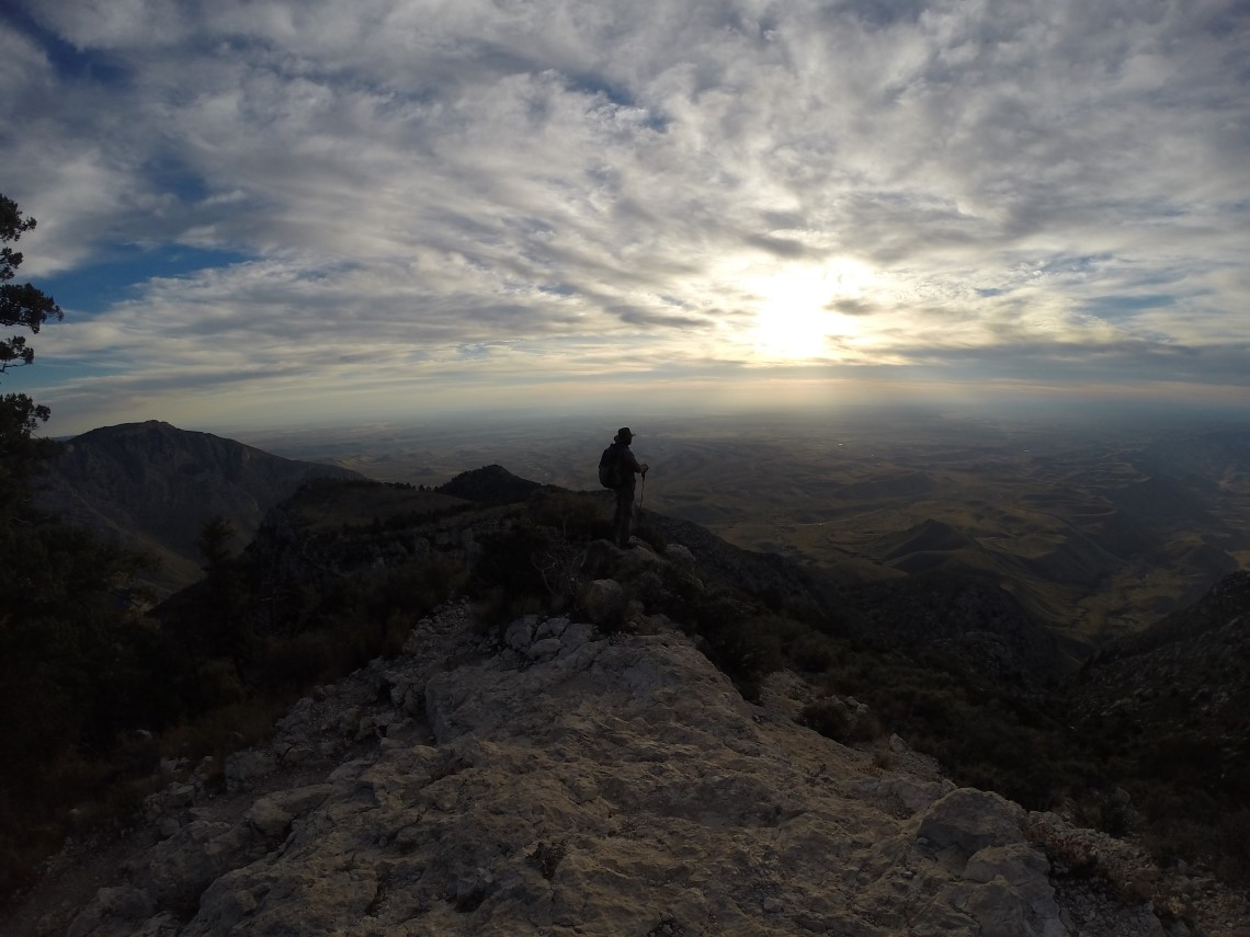
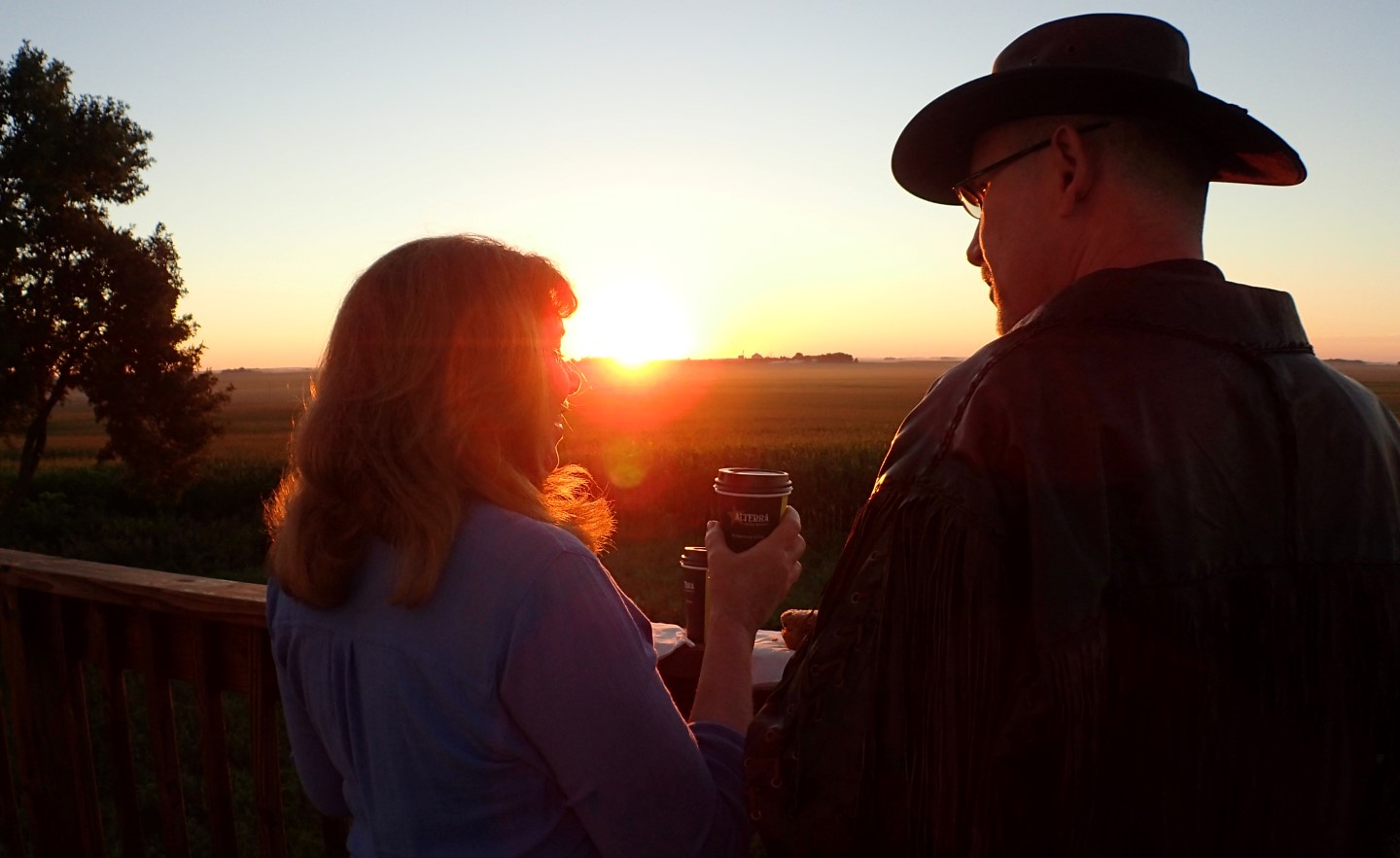
Danger and Rick stand at the Guadalupe Peak Texas summit at sunrise.
Highpoint Statistics:
Summit Date: Saturday October 29th, 2016
State: Texas
Elevation: 8,751′
US Rank by Height: 14th
Distance: 8.5 Miles
Elevation Gain: 3,015′
Round Trip Hiking Time: 20 Hours (Camped Overnight)
Highpoint Links:
Trip Report (Larger Photos Here)
Blog Posts
Photo Gallery
GPS Track – Climb
GPS Track – Road Trip
To view a sortable table of all of the highpoints with completion dates, trip reports, photo galleries, blog entries an GPS tracks, visit the US State Highpoint Page.
A Texas Story
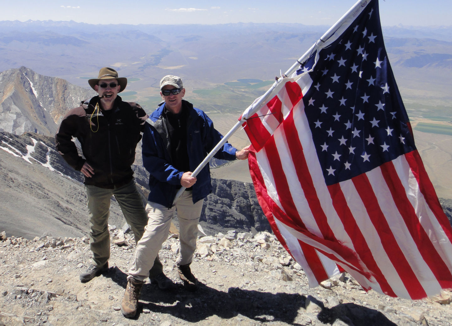
It always seemed to surprise people when they heard about my 50 by 50 goal and learned that I hadn’t done Texas yet. Having been raised, born and conceived in Texas, (not necessarily in that order), there was never any question about the proper sequence in my lone star mind. The plan was to complete the journey by standing at the top of Texas at sunrise on my 50th birthday. I was accompanied by my close friend, Rick Overholt, which was fitting since he is the one who started me on this steep and winding path when in 2010, Rick invited me to climb Borah Peak Idaho with him. Borah was my first state highpoint, and it was atop this mountain that I decided to do all 50 states.
So the journey ended, as it had began; with two old men walking up a hill.
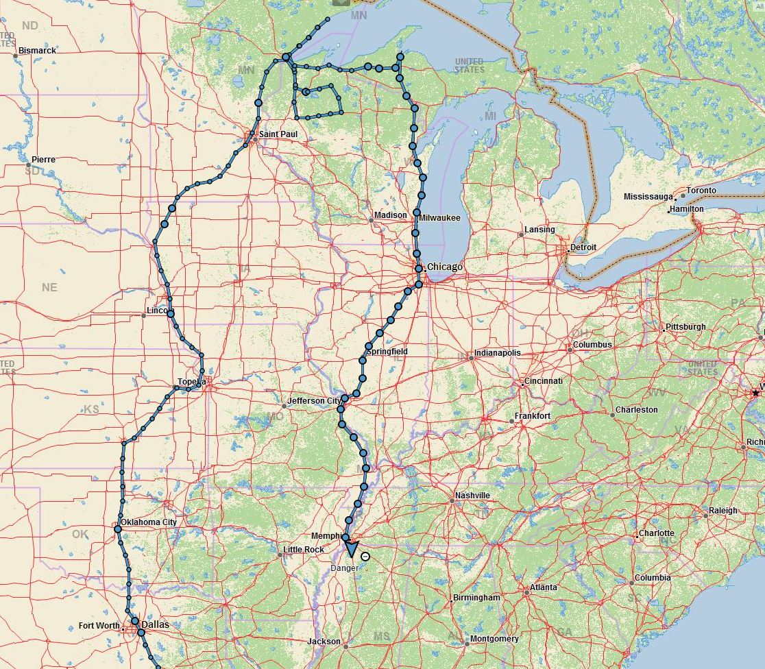
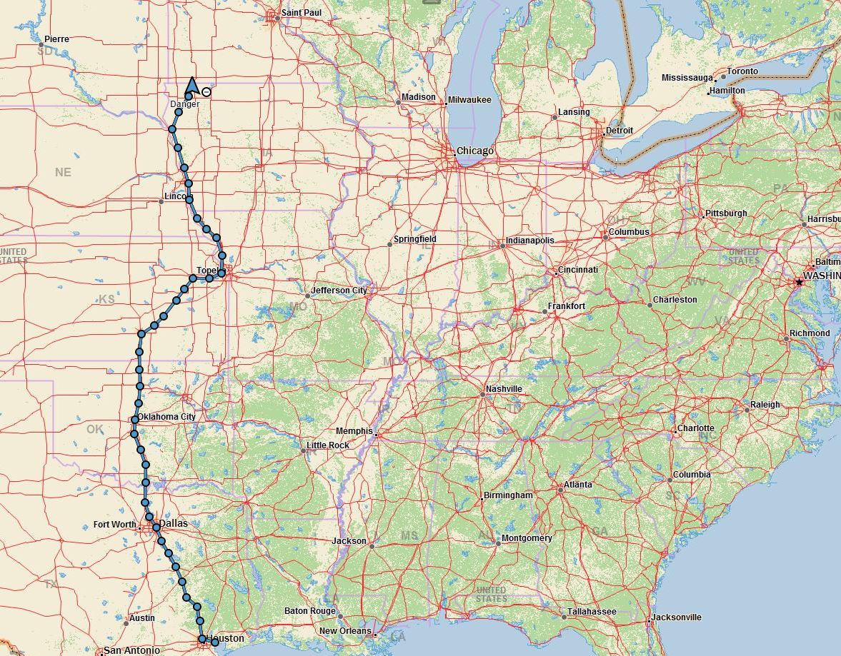
Road Trip
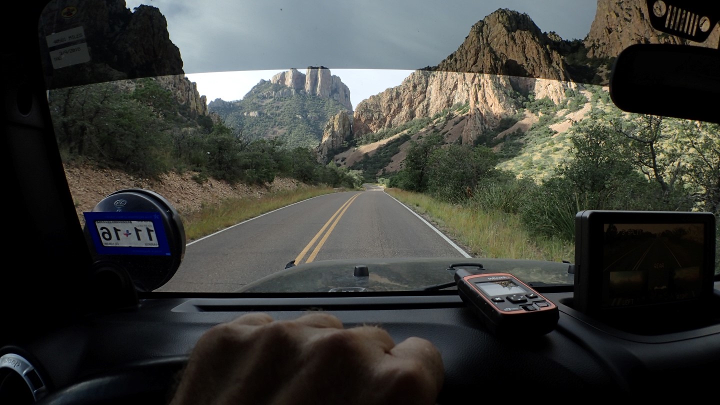
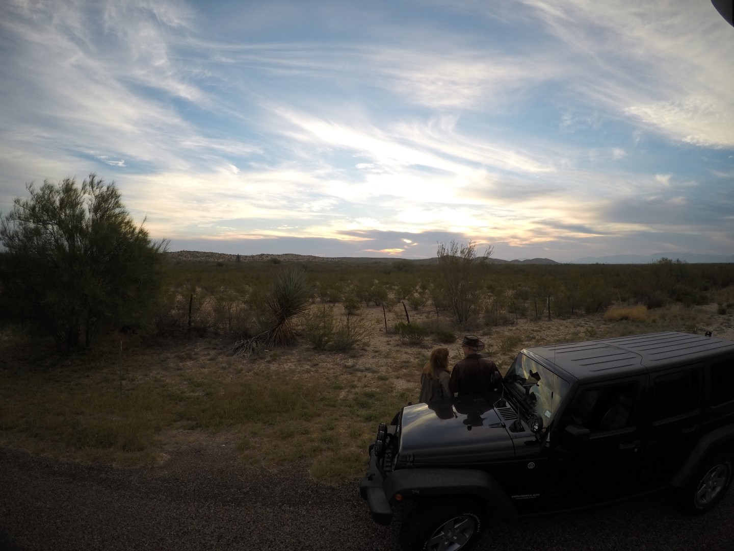
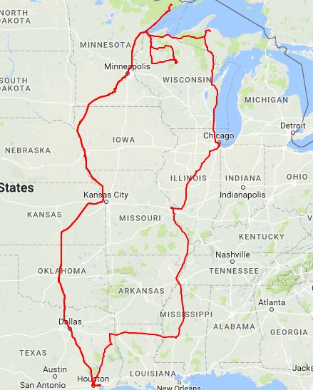
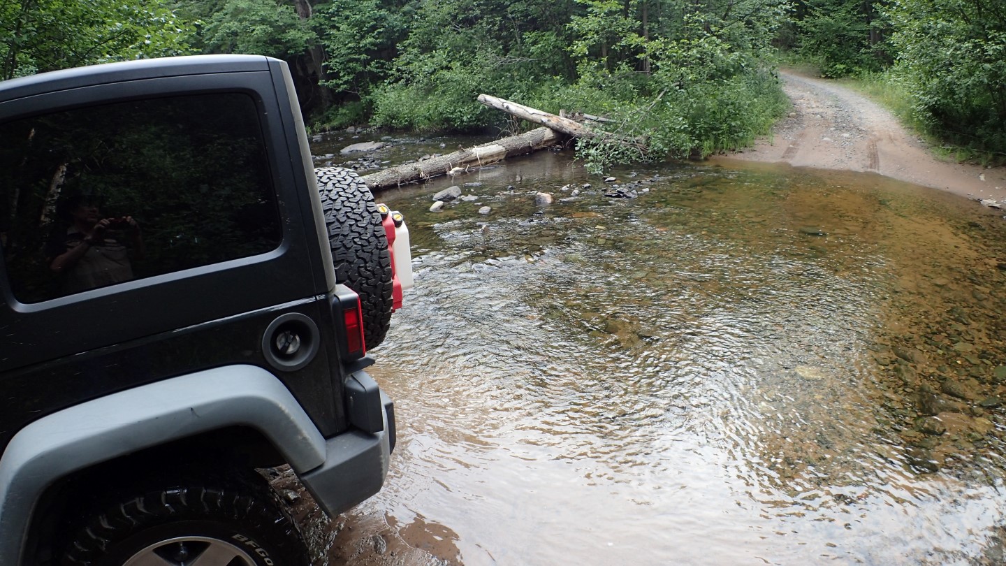
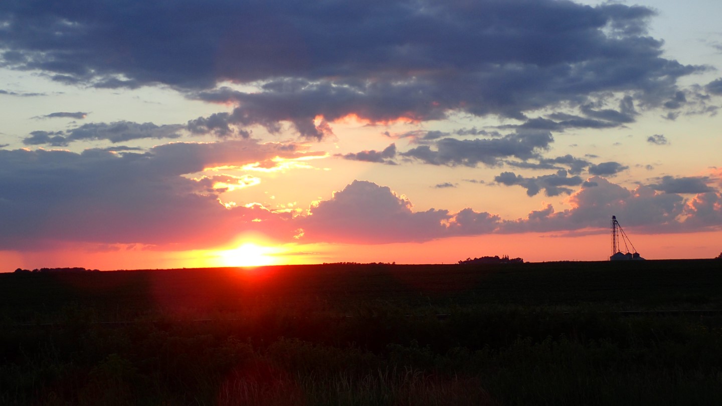
Guadalupe Peak is just about as far west as you can go without leaving Texas. The round trip to West Texas was just shy of 1500 miles. Susan and I drove out in our motor coach, which we lovingly call “BigByrd”.
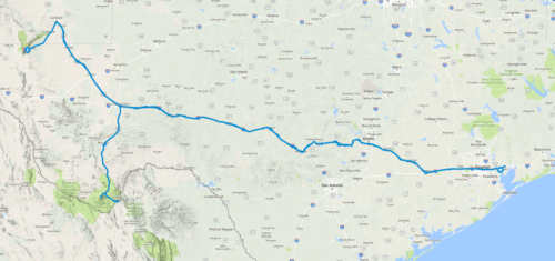
The 1,500 mile trip took us across Texas and back.
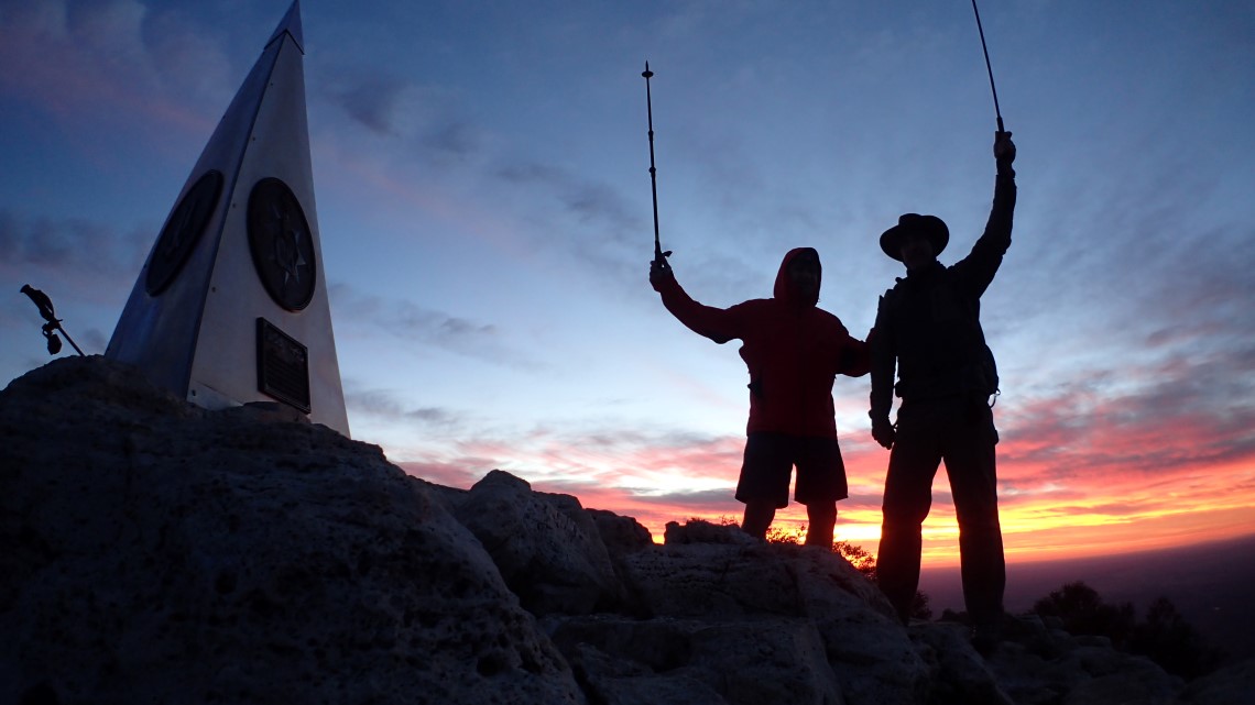
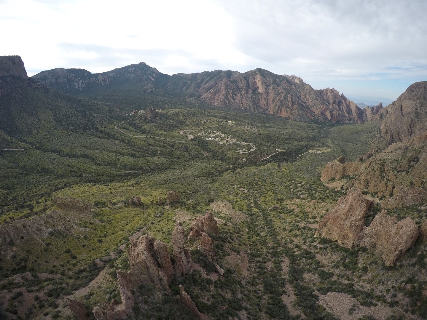
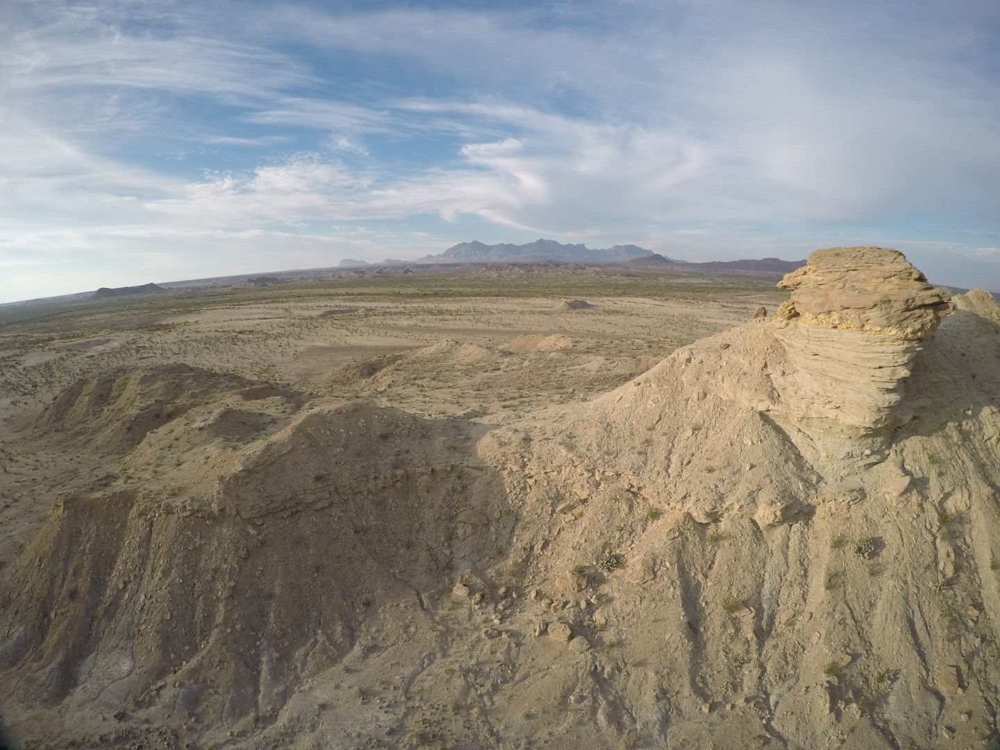
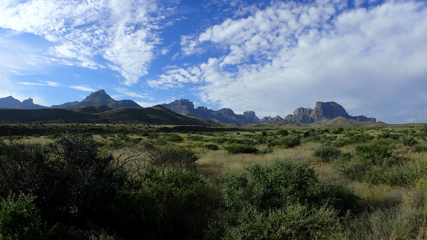
On the way there, Susan and I visited Big Bend for the first time and found it to be an awe inspiring place worthy of a return visit. We saw some interesting wildlife (coyote, road runner, jack rabbit, deer, tarantula…) and lots of remarkable terrain.
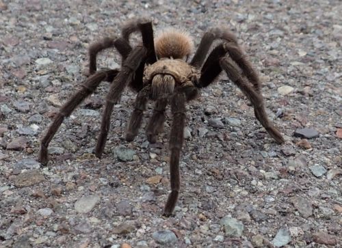
This rather large tarantula was blocking traffic, in Big Bend until we shooed him off the road.

We rescued this little guy and brought him home to our granddaughter who is still deliberating on what to name him.

Driving through the park was awe inspiring.
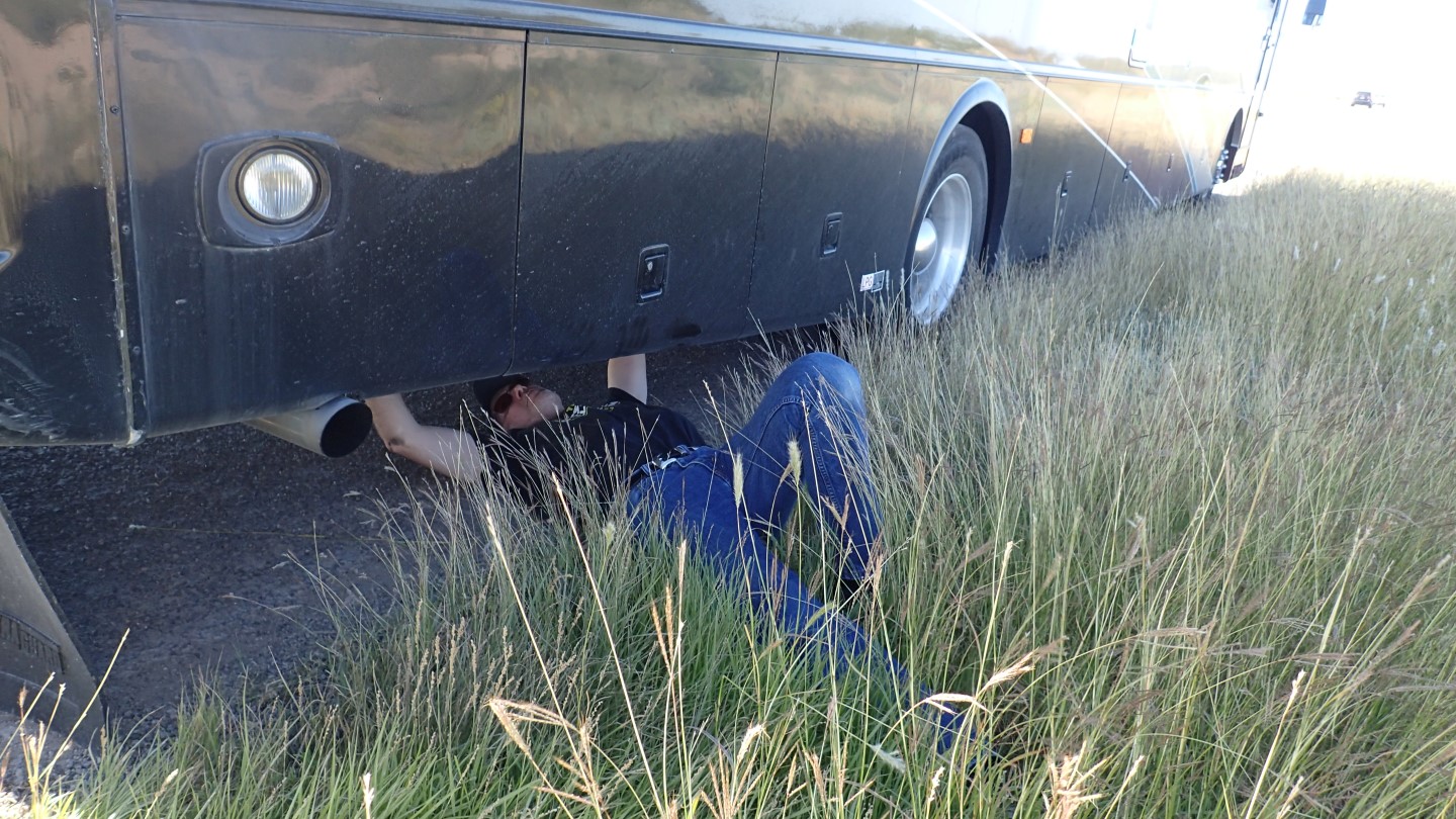
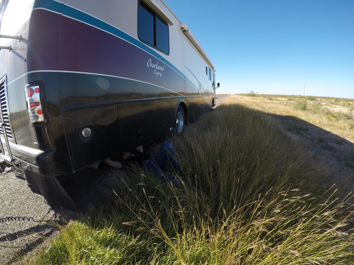
As usual, some things broke, and I had to employ the duct tape and baling wire. Word to the wise, if you don’t like fixing things, don’t buy an RV.

Danger repairs the rear air dump valve on BigByrd.
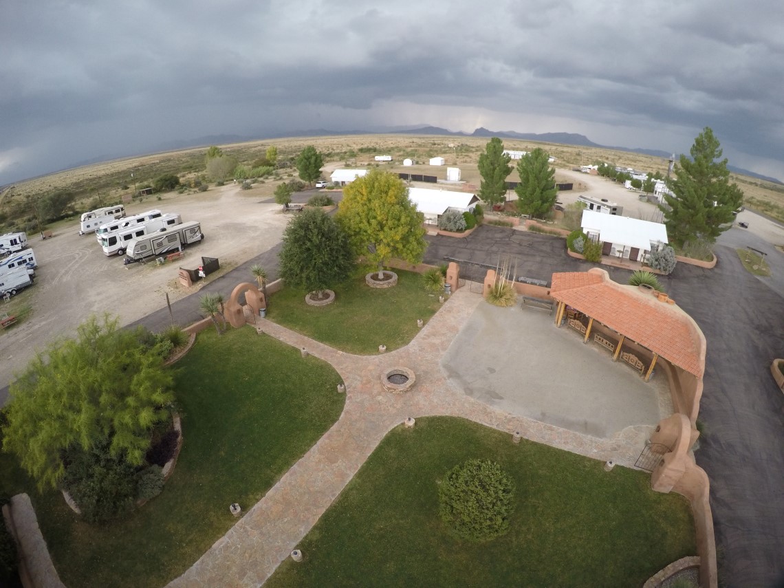
While visiting Big Bend, we stayed in Marathon, at the Marathon RV Park, which is just north of Big Bend. They had a wonderful central courtyard that always seemed to attract people in the evenings. Our last evening there was during a lightning storm and the entire town was without power. Being in an RV, we had simply started the generator so the power outage didn’t affect us.

The central courtyard of the Marathon Hotel and RV Park
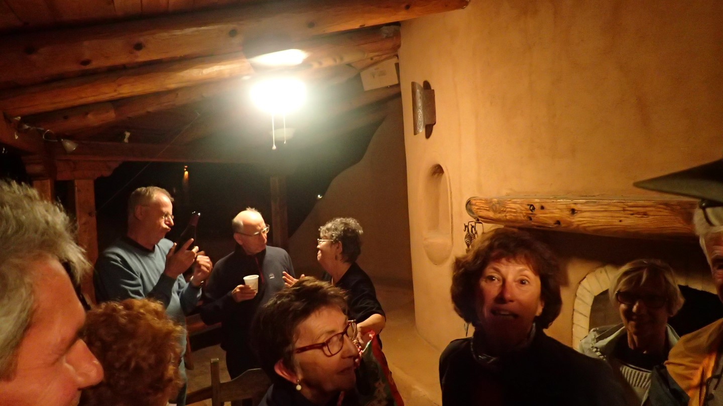
Ambassador Susan
The night of the power outage we joined friends around the fireplace in the courtyard to enjoy a bit wine and cheese. Soon a group of about a dozen french people joined us in the courtyard. They were inquiring about a place to eat. But since the entire town was in a blackout, the restaurants were closed. So we shared the wine and cheese, and Susan went back to the coach to cook course after course for the french. And let me tell you the french can eat. In the end, they said that we had altered their opinion of Americans for the better, and they would go back and tell their countryman. So you have Susan to thank for better international relations with France.
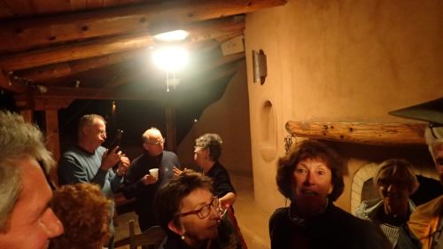
The hungry French masses…
Carlsbad
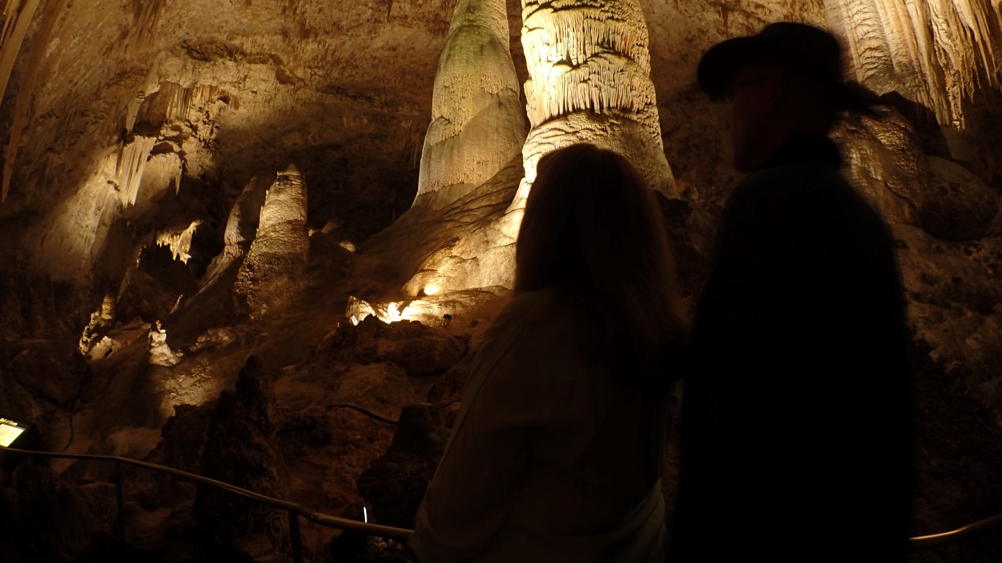
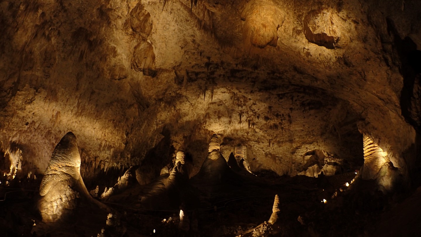
From there we proceeded to Carlsbad where we met Rick and Kathy, who had flown into El Paso. You can’t go to Carlsbad without visiting the Carlsbad Caverns, and so we did. Of course, it was amazing. Carlsbad is one the largest caves in the world, and is a must see.

Susan and Robert in the Carlsbad Caverns Hall of Giants
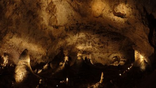
One of the expansive rooms in Carlsbad Caverns.
The Mountain
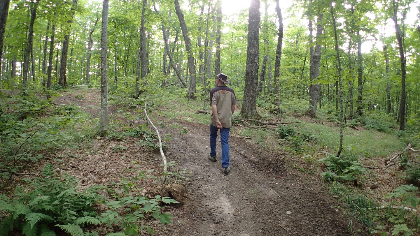
Guadalupe Peak is not a technical climb and requires no special equipment. However, it is an 8.5 mile round trip hike with just over 3,000 feet of elevation gain. It is a moderately steep climb, which demands that you be in good physical condition. The trails are well marked and easy to follow, which having been lost many times on highpoints, I can appreciate.
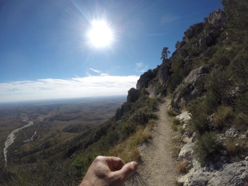
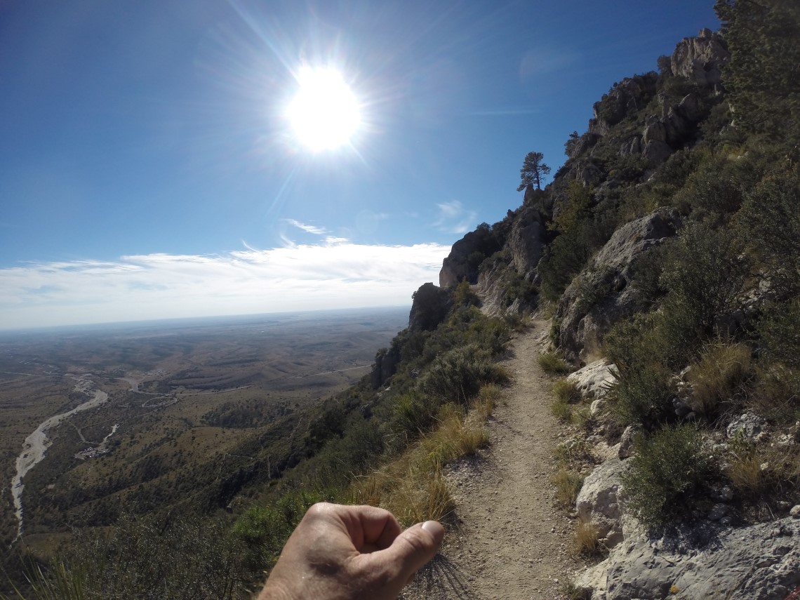
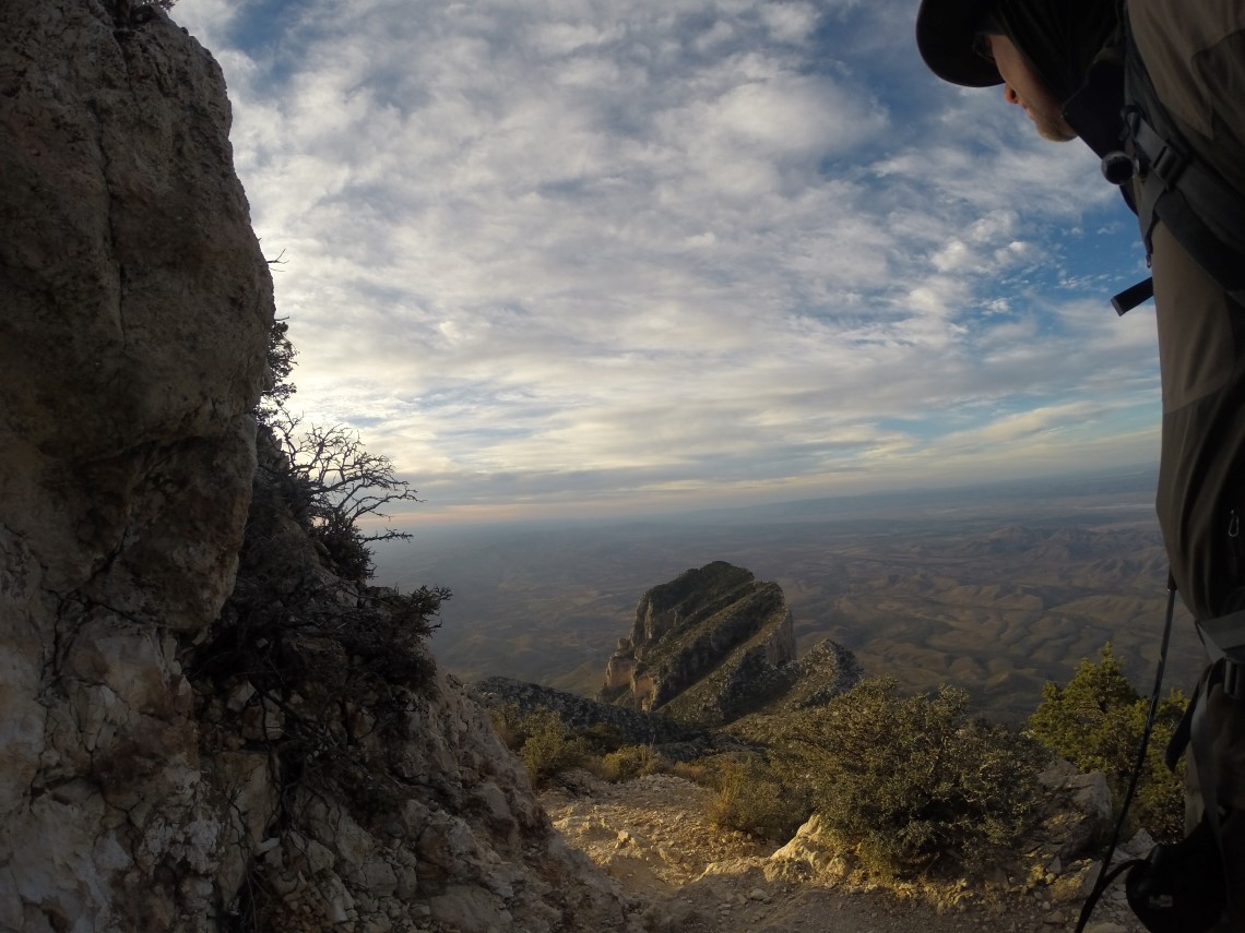
Much of the switchback style trail wound up the mountainside with a wonderful west Texas valley view.
We left the trailhead at 4PM on the 28th with the weather wonderfully cool. Temperatures were in the mid 60s, dropping to the low 50s, as we climbed. The winds coming off the desert here are infamous for their ferocity, and speeds of 120MPH are on record. According to a park ranger, RV trailers have been blown around like tumbleweeds. So we were quite pleased to find gentle 5 – 10 MPH winds. At some places, the trail is shoulder width with sheer cliffs you can peer down, if you are brave enough. I can see how this could be unnerving in extreme winds. It is in these exposed sections that the views are the most expansive, and the bald, rolling hills seem to continue into infinity. The beauty draws your eyes up and out, but the narrow trail demands your attention, so I found myself stealing quick glances along the way while, also, closely watching my footing.
Happy Campers
This mountain can be climbed in a single day, but we opted for an overnight trip to make for an easy sunrise summit. Rick and I both enjoy camping in the mountains, and look for every opportunity to do so. There are no mountain streams to refill your bottles, so we brought plenty of water. We selected one of the sites deep in the camping area that was far down the mountainside, giving us a great view of the sunset. The sites were large, level, and featured eyelets in the wood boundaries for securing guy lines. It is typically very windy on this mountain, so that is a helpful feature.
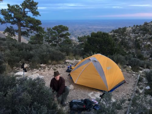
Danger at the 8,100′ campsite.
It was an unusually quite night, especially considering Guadalupe’s tendency for gale force winds. Whether due to wind, rain or snowstorms, mountains are typically noisy and I have grown accustomed to sleeping well in those conditions. This night was eerily quiet, and I woke up numerous times.
We awoke before dawn to find the wind had picked up considerably. With a breakfast of bars, we packed up and headed to the summit.
Spirits in the Sky
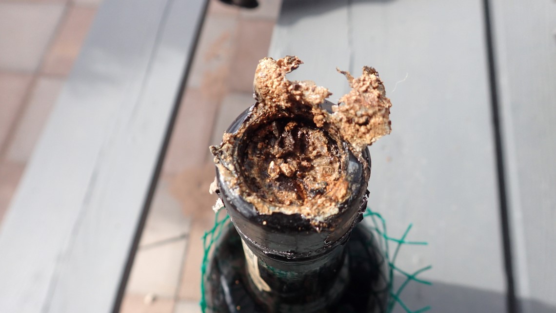
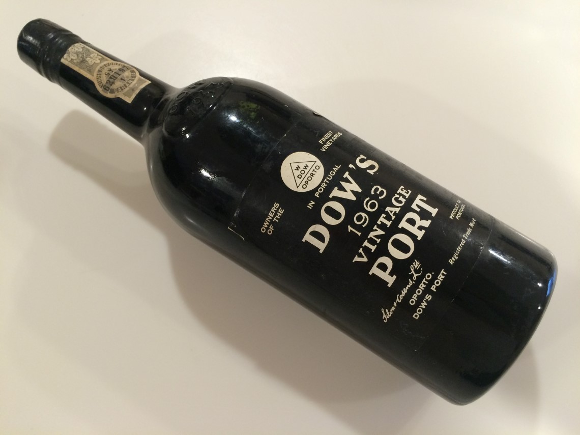
My stepson, Chris Britt, had given me a 53 year old bottle of port, for toasting at the summit. Back in Carlsbad while loading our gear, we noticed the cork had disintegrated. We feared the rare wine was ruined, but Susan saved the day by straining it and transferring it to a much lighter bottle. After a bit of sampling, (Warning! lame pun ahead) pronounced it in good spirits.
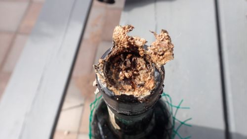
We were concerned the port was bad when we saw the cork had disintegrated, but all was well.
Sunrise Summit
We started up the mountain towards the summit around 6:15AM, to make the 45 minute climb to the summit in time for the 7:15 sunrise. It is a curious thing climbing your way up a mountain in the dark. Your vision is limited to the beam of your headlamp, but you still have a feel for your surroundings. Perhaps it is the sound, or the air movement, but you can sense the immense mass of the mountain on one side, and the vast open space on the other. It is both simultaneously reassuring and anxiety producing.
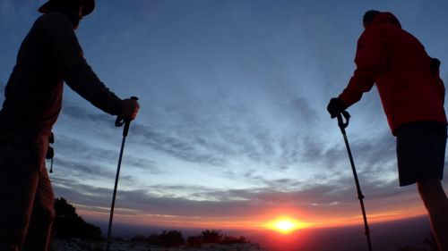
Danger and Rick waiting for the sunrise.
We arrived on schedule and found the summit to be even windier, but not uncomfortably, with temps in the low 50s. We were just in time for the sunrise, and settled in near the summit, in the lee of a rocky ledge, facing east. There we smoked Cuban cigars and toasted with the remarkably fine vintage port, as the most magnificent sunrise unfolded before our eyes.
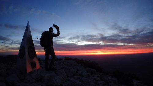
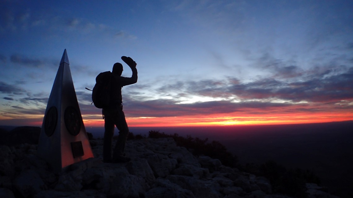
Danger, hats off to Texas.

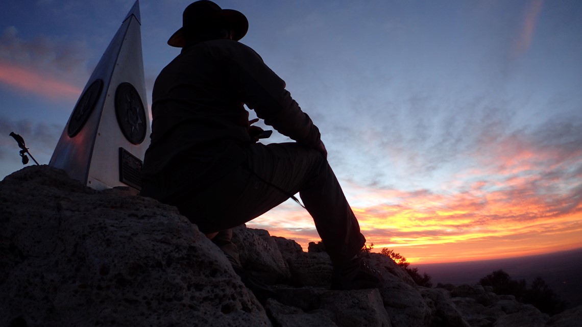
Danger seated at the summit
We took quite a few photos, but they do not do justice to what we saw. For the full experience, you will have to climb the mountain yourself and stand there on a perfect day while the sun rises over the valley below.
Summit Marker
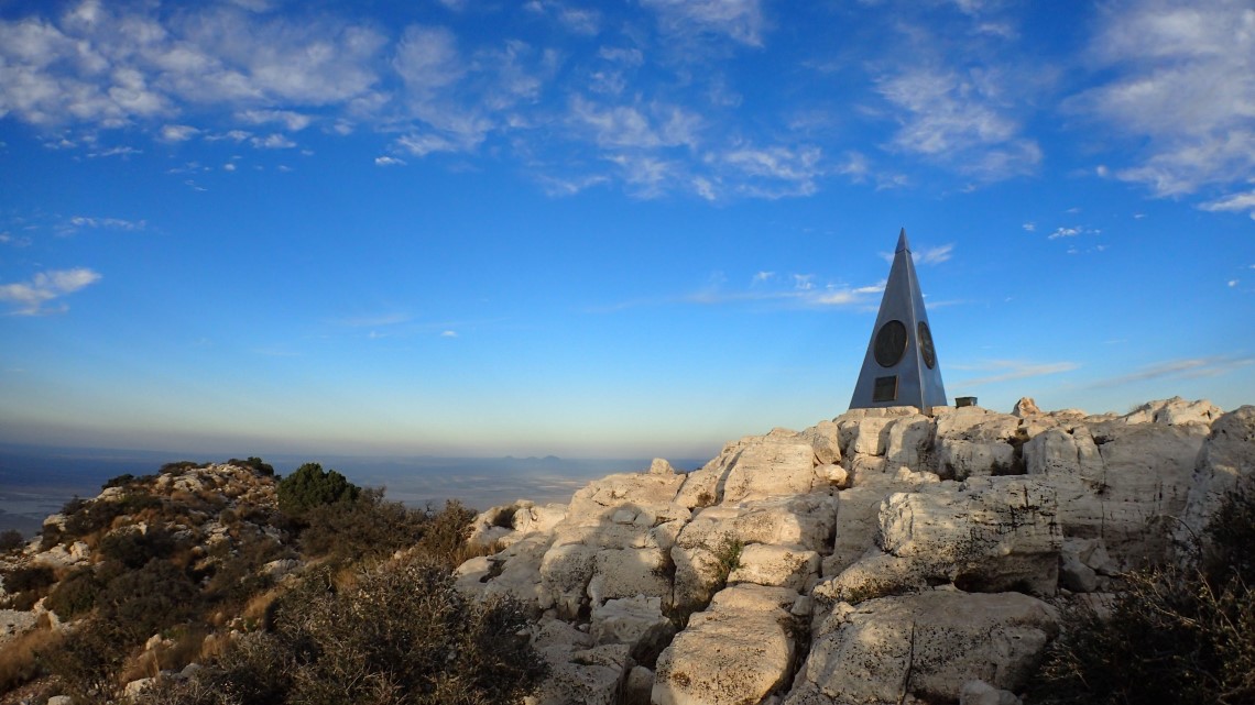
In 1958, American Airlines erected a 6′ tall stainless steel, three sided pyramid on the summit, which featured on one side a tribute to the Pony Express Riders of the Butterfield Stage which passed nearby, on another side the logo of the Boy Scouts of America, and of course, on the 3rd side the American Airlines logo. This type of mountaintop marketing is unusual and would not be possible today, but it was done before the park became government property in 1972. Up to that point it was privately owned, and before that inhabited by the Mescalero Apaches who used the high ground to strategic advantage.

The curious pyramid summit marker, placed there by American Airlines in 1958.
I stuck around to shoot a few more photos as the sun climbed higher and took these shots on my way back down to camp.
Rick departing the summit

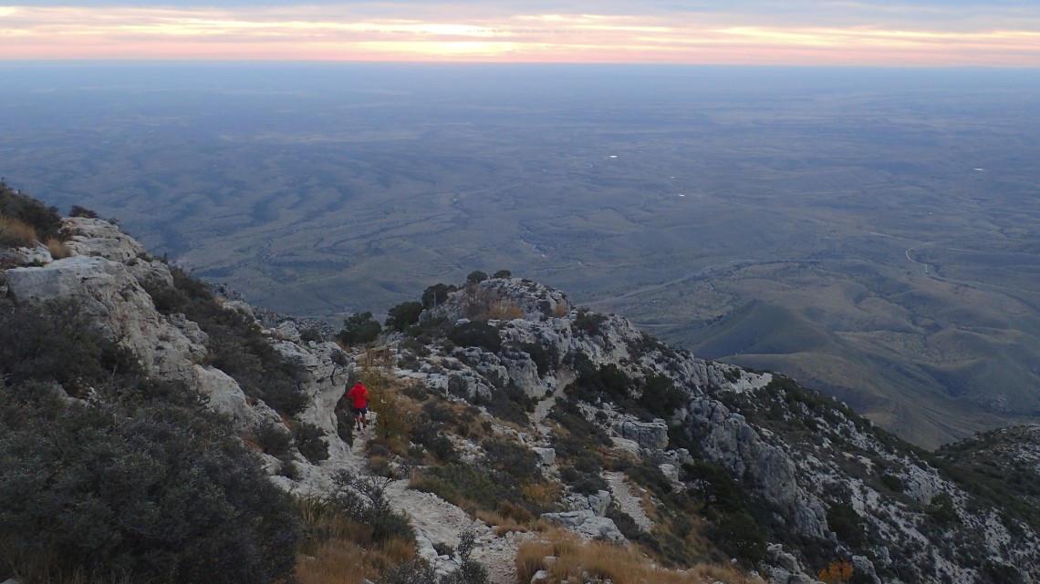
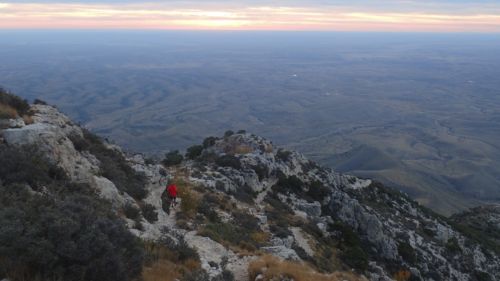
Just below the summit, looking down at El Cappitan.

There were many beautiful vistas coming down from the summit.
Back at camp, I ask Rick how he is feeling, and he replies; “It feels good to be a gangster!”. Rick is on a hip hop kick, you see, so we broke down camp to music that old men have no business listening to.
Celebrity Treatment
Rick left camp ahead of me, while I sorted out the last of my gear and took a few more photos. After a few minutes I was greeted by a couple of young men on their way up the mountain who enthusiastically congratulated me. Rick had told them it was my birthday and I had just completed the 50 state highpoints.
Saju and Stanley were the first to enthusiastically congratulate me on my way down the mountain, thanks to Rick.
I thought; “that was nice”, and continued hiking. The next group I encountered, started singing happy birthday as soon as they saw me. The next group greeted me with a round of hand shakes and high fives chanting “DANGER!, DANGER!”. The next group shouted; “LOOK, it’s Danger!” as they surrounded me and peppered me with questions.
It happened like this over and over. There were well over a hundred people coming up the mountain that day, and all but a few greeted me. People were asking questions, congratulating me, singing happy birthday, asking for autographs and taking photos with me. It really made me feel special.
Some of the climbers confessed that Rick had told them about my 50 by 50 goal and my birthday, as he sped by and asked them to delay me so he could beat me down the mountain. Whatever his motivation, it made the descent great fun and it was my best birthday celebration, ever.
PBS Mountainside Interview
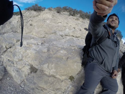
And, if all the congratulations wasn’t cool enough, I ran into a PBS crew who is filming a special by the Bargo brothers called “The Highpointers”. They too greeted me like a celebrity. They had cameras rolling as I came down the mountain. I blogged about this and many of you thought I was kidding, but I wasn’t. Below is a photo my GoPro snapped during the interview. It just goes to show that you never know what might happen on a mountainside. I have since been in contact with PBS and have granted them permission to use my interview in the upcoming pilot of “The Highpointers”.
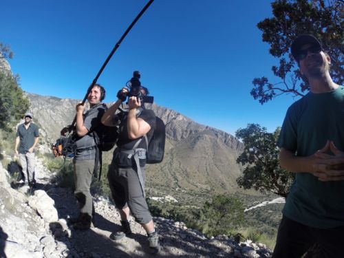
The PBS crew who interviewed Danger on the way down the mountain.
Back at the Trailhead
By this time I knew what Rick was up to, so when I wasn’t meeting a new friend, I was running down the mountain trying to catch him. Towards the bottom, I came upon to two young girls that I had not yet seen. When they saw me running towards them, they also began running down the mountain. I think they must have been spooked to find a 6’3″ old man chasing them, and wanted to keep their distance. They were faster than me and I didn’t catch up to them; so I’ll never know.
I found Rick at the bottom a few paces before the trailhead with a triumphant grin on his face. He waited for me and we walked the final steps, side by side, the same way we began this journey in 2010.
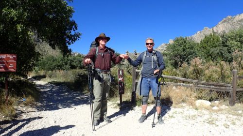
Rick and Danger back at the trailhead, and my 50 by 50 goal is accomplished!
50 by 50 Complete
Now that the goal is complete, I feel a mixture of emotions. Gratitude for the support of my wife, family, friends, sponsors and staff. Pride for having completed what was certainly the most difficult goal I have ever attempted. Awe for the beauty I have witnessed with my own eyes. And blessed for the physical and mental ability to attempt such a thing.
But I also feel a sense of loss. This goal has been a major part of my life for 6 years now. The goal took on a life of its own and was ever present in my thoughts, through the valleys, in the rain, snow, and on the mountaintops. The joy was in the journey, and now that its over, it feels like I’ve lost an old friend. This is not unusual, and is referred to as Post Achievement Depression, and often affects us when we complete our goals. The bigger the goal, the more intense the feelings. The best medicine is to get busy on the next goal, which I’m already doing, but I will always cherish this special time in my life.
Goal: 50 by 50
To walk, climb or crawl to the highest point in every state in America. – DONE!
Final Thoughts
The 50 by 50 goal has changed me in many ways: physically, mentally, emotionally and spiritually. Physically, I had to work harder than I ever have before to train my body. I started with debilitating knee problems and chronic lower back pain, but now I’m stronger at 50 than I have ever been in my life and 100% pain free. Mentally, I have learned to stay the course and push myself, harder than I previously thought possible to overcome difficult challenges. During those times when I found myself struggling up a mountain and every step was agony, it wasn’t strength, but mental determination and force of will that kept me moving upwards. Emotionally, I have learned to be happy wherever I am; whether I lay my head down in a hostel, a glacier or a mountaintop, I’m OK. And spiritually, I am in awe of a God who would care enough to take the time and create such a wonderful planet for me to explore.