Author Archive

12 Aug

Great Lakes Highpoint Trip Underway!

In State Highpoints by Robert Danger Byrd / August 12, 2016 / 0 Comments

Times are hard for the Byrd family, last night we slept in a Walmart parking lot in Ennis Texas. OK, so its not as dire as it sounds, Walmart is a pretty swell place to stop with your RV on long trips. This morning I even brought Susan coffee in bed, which makes her feel loved, and more inclined to drive 😉

As you read this, Susan and I are in BigByrd making our way across America in pursuit of 4 more state highpoints located in the Great Lakes area. My coffee ploy having worked, Susan is at the wheel, and I’m at the desk.


The plan is to catch Hawkeye Point Iowa on our way north, and then continue to the  Great Lakes to complete Eagle Mountain Minnesota, Mount Arvon Michigan and Timm’s Hill Wisconsin. As always, you will be able to follow along real time here on The Danger Map 

Read more →

28 Jul

Back at Humphrey Trailhead

In State Highpoints by Robert Danger Byrd / July 28, 2016 / 0 Comments

I’m back at the trailhead now, in my rental car with the AC blasting chanting “There’s no place like Camry, There’s no place like Camry, There’s no place like Camry.

I must have found my inner pathfinder because I never lost the trail coming down. But I lost it 4 times on the way up.

I got lucky with the storm and stayed out of its reach as I quickly moved down the mountain.

This climb only took me 7.5 hours, but with the rough boot shredding terrain, wrong turns and heat, it felt like a much longer climb.

I’ll write a full trip report later.

28 Jul

Mt Humphrey Take 2

In State Highpoints by Robert Danger Byrd / July 28, 2016 / 0 Comments

Today I make my second attempt on the 12,633′ Mt Whitney.

I did move the climb day up due to potential thunderstorms tomorrow, but when I checked the weather this morning it looks fine either day. Since I was geared up, I decided to go ahead and get it done today.

The drive up the mountain road was not as exciting as last time in the absence of fresh deep snow.

I’ve got less than 25 pounds of gear all in, and it’s cool in the 50s at the moment, so it should be an easy day. Although I do expect extreme heat later on. It was 115 degrees yesterday during the drive from Phoenix.

I’m at the trailhead now getting geared up and will be leaving soon.

27 Jul

Second Attempt on Humphreys Peak AZ

In State Highpoints by Robert Danger Byrd / July 27, 2016 / 0 Comments

A tall dangerous man steps off a plane, the other passengers give him a wide berth, as he purposefully makes his way up the ramp…

Yea, that would be me. Today I find myself in Arizona in full adventure mode. I’m here to take a second swing at Humphreys Peak, the highest mountain in Arizona and this time, I will not be denied. When I tried this mountain in April, I got caught in a proper blizzard, and had to turn around around 1,400′ from the summit.

Severe weather forced me to abort the first Humphrey attempt in April.

Severe weather forced me to abort the first Humphrey attempt in April.

The chance of blizzards is pretty low this time around, but the heat could be problematic, its 113 degrees in Phoenix today but it will be cooler on the mountain, hopefully a lot cooler. Then there are thunderstorms forecasted this week. My original plan was to take a rest day on Thursday and climb Friday, but the weather looks more favorable on Thursday. So well see what the mountain has to throw at me this time, and hopefully I’ll be up to the challenge.

Highpoint Statistics:
State: Arizona
Elevation: 12,633′
US Rank by Height: 12th
Round Trip Hiking Time: 7 Hours

If you have some time to kill, you can read that first trip report here.

In the meantime, stay tuned to the Danger Network…

24 Jul

Mt Hood Trip Report Posted

In State Highpoints by Robert Danger Byrd / July 24, 2016 / 0 Comments

Tuesday July 12th, 2016 I stood on the summit of Mount Hood, the state highpoint of Oregon. This was #44 out of 50 for me. This was a hard won summit, with my first attempt ending in failure after being turned back 700′ from the summit due to weather. The second attempt was also not without its challenges, so when I finally did make it, it felt like I had really accomplished something.

Hood has a reputation for nastiness, and has killed over 130 people. It’s one of the higher death tolls for US mountains. Even so, I was still surprised the intensity and variety of her wrath. Why is Hood a female? Because a male mountain doesn’t really care if you climb him or not, he’s indifferent. But a female mountain will fight you all the way to the top. And fight she did, throwing freezing rainstorms, icy winds, whiteouts, avalanches, hailstorms and even a fall for good measure.

As I mentioned, it took two attempts to bag this one, and the stories are tightly linked, so I have combined them both into this one trip report.

A very happy Danger stands on the summit of Mount Hood.

A  happy Danger stands jauntily on the summit of Mount Hood.

Highpoint Statistics:
Summit Date: Tuesday July 12th, 2016
State: Oregon
Summit Elevation: 11,249′
Trailhead Elevation: 5,860′
Elevation Gain: 5,389′
US Rank by Height: 13th
Round Trip Hiking Time: 13 Hours

Highpoint Links:
Trip Report – You will see larger photos here.
Posts
Photo Gallery #1
Photo Gallery #2
GPS Track #1
GPS Track #2

To view a sortable table of all of the highpoints with completion dates, trip reports, photo galleries, blog entries an GPS tracks, visit the US State Highpoint Progress Page.

About the Mountain
Mount Hood, was called “Wy’East” by the American Indians who once inhabited the area. Hood is a potentially active stratovolcano located only 50 miles east of Portland. Steam is constantly spewing from fumarole areas and sulfuric gases are a hazard for climbers. Eleven glaciers grace Mt. Hood’s peak and the Timberline Ski Lodge is situated at the base of the mountain. At 11,249 feet, it is Oregon’s highest mountain as well as being one of the most visually impressive mountains in the nation based on its geographical prominence.

Read more →

12 Jul

Mt Hood Oregon HP #44 Complete

In State Highpoints by Robert Danger Byrd / July 12, 2016 / 3 Comments

So state highpoint #44 is officially in the bag. I’ve been back at the trailhead for an hour, loading & sorting gear, changing out of my wet clothes, which was not fun in freezing windy conditions.

This was a very big day. A full 13 hours of non stop intensely physically challenging and technically demanding work. This was the most technical mountain I have climbed yet, and it definitely sharpened my skills and showed me some weak points.

I’ll post a report later, but for now, I’m going to go find me a wilderbeast to eat.

12 Jul

Hood Second Attempt Begins

In State Highpoints by Robert Danger Byrd / July 12, 2016 / 0 Comments

Geared up and leaving the trailhead now where it’s a balmy 48 degrees. More wind than expected, but otherwise weather is good.

11 Jul

Mt. Hood Second Attempt Action Plan

In State Highpoints by Robert Danger Byrd / July 11, 2016 / 2 Comments

If you’ve been following along, you know my first Attempt on Mt. Hood was a bust due to weather.  Here’s the plan for my second attempt.

The visibility during my first attempt was very limited.

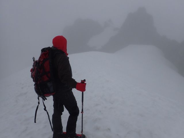
Visibility during my first attempt was insufficient to navigate the technical climb to the summit.

The climbing season ends soon, so I need to finish it this trip to make it by my 50th birthday, so I cancelled my return flight, extended my room and car and stayed. It has been suggested to me that it would be OK to slide a bit and do it during my 50th year, but that’s not the goal. The goal is 50 by 50, so I’m going to give it my best effort to complete the goal on time.

Going Solo
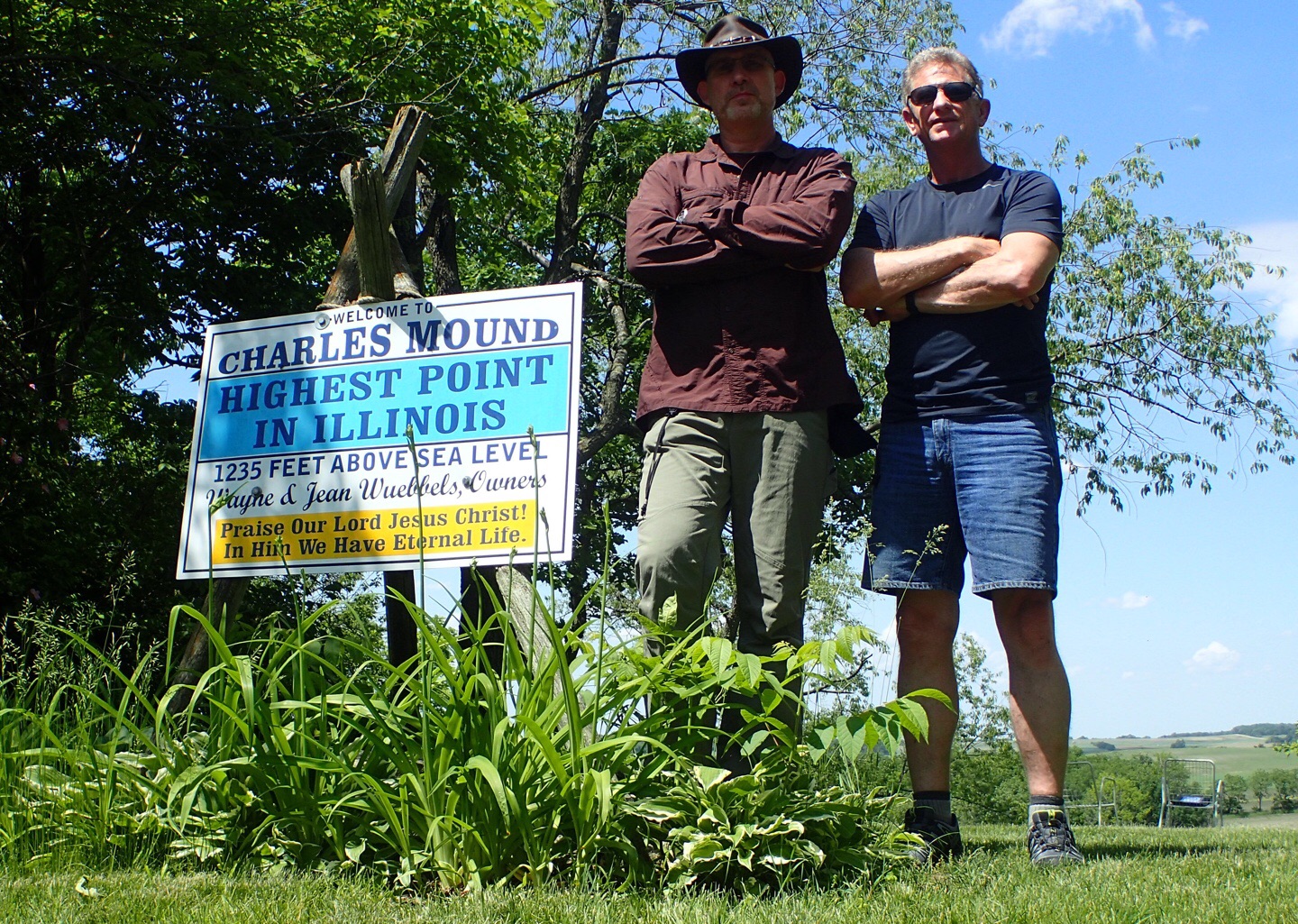
I’m going to climb it solo and here’s why; first because my previous Guide Ben was confident that I’m a strong and competent enough climber to handle it and thought my chances would actually be better than going with a guided group as weak climbers often turn those around. I could do another private guide like before, but the guided trips all use snow cats and or ski lifts to get higher on the mountain, and I want to climb it all myself. Also because I have been within 700′ of the summit already and did not find it particularly taxing, although the last 700′ are extremely steep, but I’ve climbed vertical ice walls before and have the skills, strength and experience. And finally because I’m a manly man and Old Spice said I could have another shot at the contract if I went solo. If that joke doesn’t make any sense to you, take a look at the Illinois highpoint trip report.  

One Day Up And Down
It will be a single day, climb this time because I don’t need the head start that the camping gives you and it makes logistics simpler.

Weather
The weather has greatly improved, and Monday, Tuesday and Wednesday are all clear days. Tuesday has below freezing temperatures which will keep the snow firm and reduce the chance of rock fall and avalanches. So Unless the weather changes, Tuesday is the day.

Lighter Load
I have secured some gear from the local climbing shop, mainly a lighter pack to replace my 8 lb expedition one and a few other items to lighten the load and fill in gaps created by the new plan. I had 60 lbs of gear the first time, I expect to have 25lbs or less this time.

Timing
I’ll start at 11:00 PM on Monday, and climb the whole darn thing myself thank you, none of that lame ski lift nonsense. I hope to be at the summit around sunrise and back down before noon. It’s important to get up and down early for better snow conditions. The steep upper slopes especially become slushy when the sun hits them as well as the aforementioned rock and avalanche risk.

I have shifted my sleep schedule so I can get 8 hours sleep today from 2:00PM – 10:00PM before I leave at for the mountain to start climbing at 11:00PM.

But as they say, no plan survives contact with the enemy, so I’ll keep you posted.

10 Jul

Mt. Hood Attempt #2 Plan

In State Highpoints by Robert Danger Byrd / July 10, 2016 / 0 Comments

If that doesn’t make any sense to you, take a look at the Illinois highpoint trip report.

08 Jul

Back at Trailhead

In State Highpoints by Robert Danger Byrd / July 8, 2016 / 1 Comment

Back at the trailhead now.

Because the climbing window closes soon, I need to stay and try again.

I will formulate new plan and post an update.

Ben suggested I should solo it, and I’m considering it as well as other guided options.

08 Jul

2;30 AM and Raining Still

In State Highpoints by Robert Danger Byrd / July 8, 2016 / 0 Comments

2:30AM and rain is back, so we wait for an opportunity. It is well below freezing higher up, so we need to stay dry or we risk hypothermia.

I do love a good challenge but don’t care to become a DangerSickle.

Had a hearty breakfast, and will continue consumption of mass quantities until we leave. Summit day on hood is 8-12 hours and a man my size will burn around 7,000 calories on such a climb.

Our low pressure window up high has expanded, so weather up higher should be better for longer, we just need to get above the rain/freeze line.

For now, we wait…

08 Jul

No Rain!

In State Highpoints by Robert Danger Byrd / July 8, 2016 / 0 Comments

12:30 AM Update:

Temp hovered just above freezing and it rained most of the night.

High humidity and cold irritating my throat and sinuses.

There is a low pressure window at 5:00 AM that may give us an opportunity to summit. We need to be in position at the Hogs Back Ridge below the summit to take advantage of it.

Windy but no rain, so we will be moving higher on schedule.

07 Jul

A Blustery Evening

In State Highpoints by Robert Danger Byrd / July 7, 2016 / 0 Comments

Been sleeping since 4:00 PM, and will wake at 12:30 gear up and move out weather permitting. Rare to get a good nights rest before summit day. Have literally had as little as 3 hours before a 16 hour summit day so getting a full night is quite a luxury. Sunset was at 9:00 and it’s a bit challenging to sleep with the light. Wind buffeting the tent also does not help, but eventually it becomes normal and I awake when the wind stops.

07 Jul

Storm Is Coming

In State Highpoints by Robert Danger Byrd / July 7, 2016 / 0 Comments

Ominous clouds line the horizon, & forecast looks bad for summit attempt tomorrow. We are going to push for it, but chances of success are 50% according to my very personable guide Ben.

Ben suggested we take the ski lift partway up which shaved 2.5 hours off the climb. I told him I felt like a dirty lowdown cheater but he wanted to beat the rain and it was a good call as it started raining soon after camp was complete. I’ve been caught in rain before and all of my clothing layers, sleeping bag, socks, everything got wet and did not dry for days. Trust me alpine climbing in soggy underwear is not fun.

We will wake at 1:00AM, if storming we will try later.

Ben is a Sagittarius.

06 Jul

Headed for Oregon

In State Highpoints by Robert Danger Byrd / July 6, 2016 / 1 Comment

Tomorrow, I’ll be climbing an active volcano covered in glaciers and loose avalanche prone snow. It’s not really as crazy as it sounds, well maybe it is…

The aforementioned mountain is Mt Hood, the tallest mountain in the state of Oregon and my 44th state highpoint if all goes according to plan. Hood is only 11,249 feet tall, but it has a nasty reputation and a respectable 5,319′ elevation gain exceeded only by Denali and Rainier. Over 130 climbers have died on Mt Hood, typically due to falls from the steep icy slopes, but avalanches which are more common on steeper mountains, have claimed their share of lives as well. In addition to steep and technical slopes, there are also active steam vents and sulfurous discharges that destabilize the snow thanks to the volcano under the layers of glaciated ice. It will most likely be snowing, and due to the constant snow, there aren’t any trails. And oh yea, it will be windy and well below freezing, sounds perfect!

I wont be going alone, as I opted for an experienced private guide with no other climbers to eliminate the chance of a weak climber creating problems and potentially turning us around which is common on tough mountains. Hopefully I wont be that weak climber. We will start up the Mountain on Thursday July 7th, camp overnight and make a summit bid on the 8th. If I do not make it, I will cancel my return flight and make another attempt as mid July is the end of the climbing window on Hood as the sun heats up the slopes in the summer months, the snow begins to give way causing frequent avalanches. And I need to finish by October 29th this year to meet my 50 by 50 goal.

I’ll literally be watching my step on Hood. This type of climbing requires hyper focus as every footstep must be perfectly placed, since a blowout can be deadly. It is definitely not a casual climb, but I’ve done this type of extreme mountaineering before, and I have been training hard and feel ready. I’m stoked and really looking forward to seeing if I’m up to the challenge that Mt Hood presents.

07 Jun

Charles Mound Trip Report Posted

In State Highpoints by Robert Danger Byrd / June 7, 2016 / 0 Comments

On Friday June 3rd I stood at the highest point in Illinois with my good friend and highpointing mentor Rick Overholt. This was my 43rd highpoint and Ricks 48th.

Charles Mound Summit Duo Manly Men

A pair of very manly men standing at the highest point in Illinois

Highpoint Statistics:
Summit Date: Friday June 3rd, 2016
State: Illinois
Elevation: 1,235′
US Rank by Height: 45th
Round Trip Hiking Time: 20 Minutes

Highpoint Links:
Posts
Photo Gallery
Trip Report
GPS Track

You will find the entire Trip Report posted here. To view a sortable table of all of the highpoints with completion dates, trip reports, photo galleries, blog entries an GPS tracks, visit the US State Highpoint Progress Page.


03 Jun

Charles Mound Complete

In State Highpoints by Robert Danger Byrd / June 3, 2016 / 0 Comments

Rick and I are now standing on the highest point in Illinois.

The land owners are using it as a witnessing opportunity with a sign proclaiming,”Praise Our Lord Jesus Christ! In Him We Have Eternal Life.”

We checked the guest register and we are the first to come within the authorized window this season.

It is very relaxing here; quiet with clear skies, gentle winds and long views over rolling farmland. It’s a perfect day to stand on a highpoint!


03 Jun

Charles Mound Bound

In State Highpoints by Robert Danger Byrd / June 3, 2016 / 0 Comments

We are 30 minutes into the 3 hour drive from downtown Chicago to Charles Mound and are already close to exhausting our repertoire of driving games. Rick plays a mean game of iSpy and I’m about $700 down already, but I’m hoping to make it up in a game of high stakes License Plate Bingo.

The Highpoint
Charles mound is an easy 2.5 mile round trip hike. The challenge here is logistical in nature, as this highpoint is located on a private farm and therefore public access is limited to 4 weekends a year; the first weekend of June, July, August, and September.

Fun Fact
The Sears Tower (Now the Willis Tower) in Chicago rises 1,450 feet above ground with a ground elevation of 583 feet. That puts the top of the Sears Tower at an elevation of 2,033 feet above sea level, nearly 800 feet higher than Charles Mound. However, it is obviously not considered to be the state highpoint since it is man made.

02 Jun

Charles Mound Indiana Trip Underway

In State Highpoints by Robert Danger Byrd / June 2, 2016 / 0 Comments

This morning I woke up on a sailboat along with my good friend Rick Overholt. No is isn’t one of those stories where there’s a tiger locked in the bathroom and people are missing. This is a story about a journey to stand on the high places of America, and it’s a story that is drawing to an end in a matter of months. But I digress, so let’s get back to the boat.

The Beneteau sailboat has a nicely appointed cabin.

The Beneteau sailboat has a nicely appointed cabin.

This particular sailboat is docked in Belmont Harbor in the shadow of downtown Chicago, and it belongs to freind and fellow mountain climber JR Peacock. It’s a classic 35′ Beneteau with Twin cabins, rich woods, and a full suite of amenities. JR Spends a month or two out of every year traveling on it and it is going to make a great home base from which to tackle the Indiana highpoint, and experience a bit of the Chicago culture.

The Highpoint Plan

Tomorrow, Rick and I we will make our attempt on Charles Mound the 1,235′ state highpoint of Indiana and this will be number 48 for him and 43 for me. I say “attempt” because after getting shut down on the Arizona highpoint in April I’m not taking anything for granted. That said, this is an easy one, and the only challenge is that it is only accessible 3 weekends out of the year. It’s on private property, and the owners limit access. So barring blizzards, floods, tornados or frog plagues, we should have this one completed tomorrow.

19 Apr

Humphrey Peak Failed Attempt#1 Trip Report Posted

In State Highpoints by Robert Danger Byrd / April 19, 2016 / 4 Comments

So we are back in Houston and I didn’t make it to the summit of Humphrey Peak the first try. I will go back later and make another attempt, but in the meantime here is the full Trip Report of that failed attempt.

Highpoint Statistics:
Summit Attempt Date: Saturday, April 16th, 2016
State: Arizona
Elevation: 12,633′
US Rank by Height: 12th
Round Trip Hiking Time: 6 Hours

Highpoint Links:
Posts
Trip Report

To view a sortable table of all of the highpoints with completion dates, trip reports, photo galleries, blog entries an GPS tracks, visit the US State Highpoint Progress Page.