To view a sortable table of all of the highpoints with completion dates, trip reports, photo galleries, blog entries an GPS tracks, visit the US State Highpoint Progress Page.
The Story
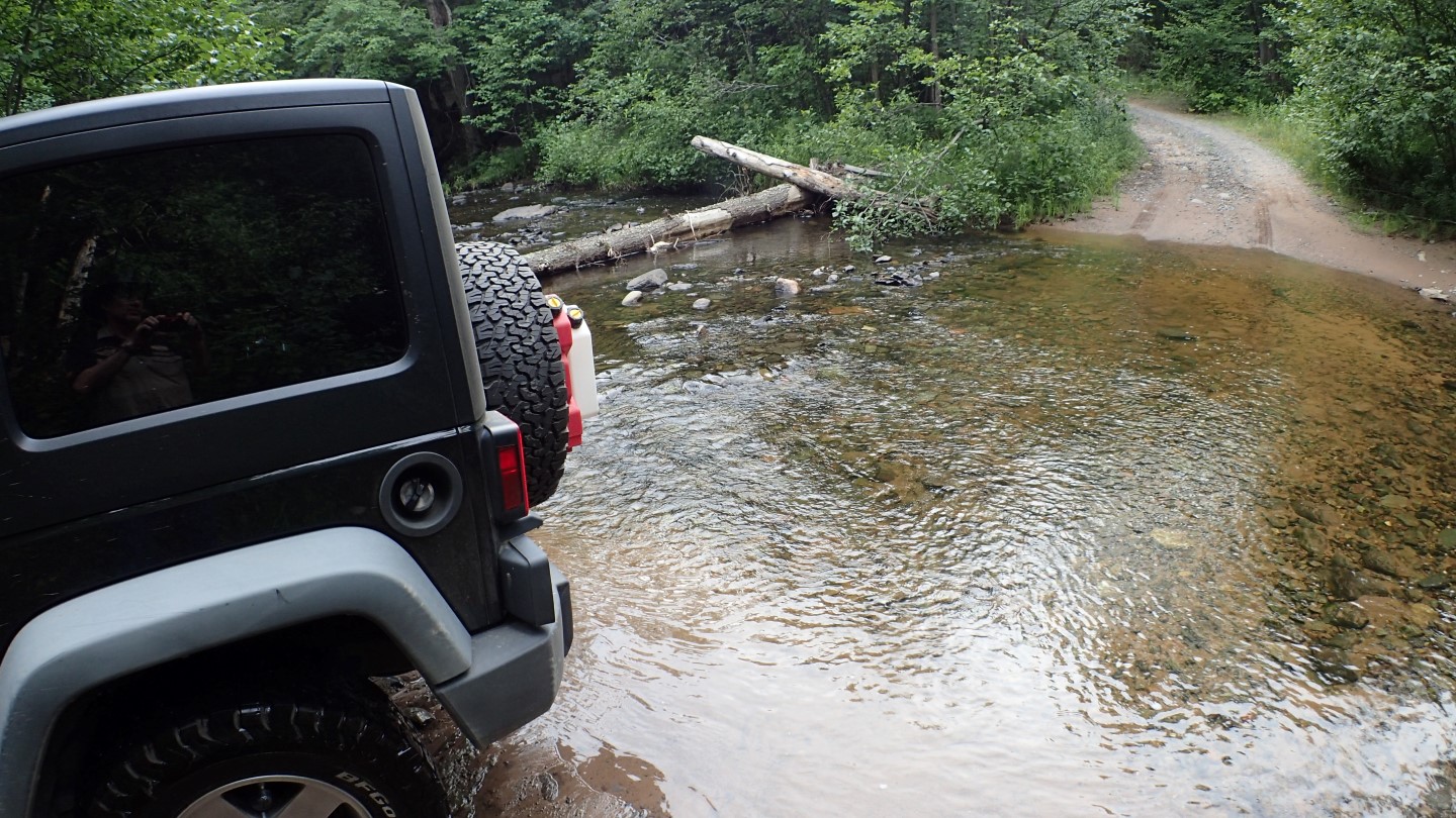
We had driven from Duluth that day, and arrived at the L’Anse Township RV Campground well before sunset and after setting up, we decided to make the one hour drive to the highpoint together. The roads were narrow logging roads in poor condition, with many, bumps, lumps and bouncy fun, fun, fun. There were also a number of water crossings that made us glad to be in the Jeep. Of course the Jeep was glad to have the opportunity to reclaim its dignity after the sinkhole incedent on Timm’s Hill. And since I had Susan along, I wasn’t likely to do anything stupid this time.
One of the water crossings along the way.
Another water crossing, no problem for the Jeep.
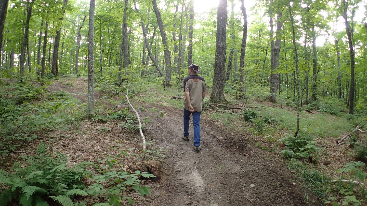
Once at the dirt parking area, it was a short walk to the actual highpoint along a peaceful wooded trail.
It is a short walk from the parking area to the highpoint.
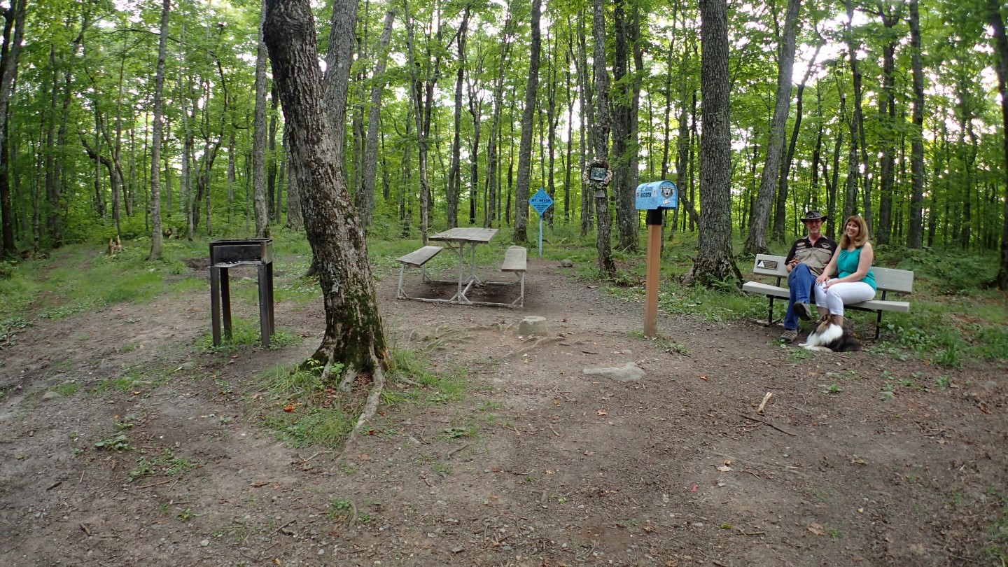
The highpoint area was equipped with a picnic table and a BBQ pit, making me wish we had brought some hot dogs or something. We relaxed for a while, enjoying the peaceful and quiet setting before braving the logging roads again.
Danger and Susan at the highpoint area.
A Quick Exit
When we arrived back at the L’Anse Township RV Campground and were getting ready for bed, it began to rain exuberantly. Since it was a grass campground and BigByrd weighs 32,000 lbs, we know from experience that bad things happen under those circumstances, so we vacated the premises in a hurry and headed towards Chicago.
And Then There was One
So now only Texas remains! We are inviting you to join us on that trip planned on my October 29th, 50th birthday, and many of you have displayed interest. We are working on the planning, so stay tuned to the Danger Network for details.
In my previous post I mentioned a video, but if you are reading this via email you will not be able to see it, unless you visit the Trip Report Page or view it on YouTube.
Below is the original text regarding the video:
Descending with Danger Video
If you ever wondered what it might be like to hike along with me, this 93 second video will give you a taste. This is the first time I have tried anything like this and I’m not sure it is worth the effort, so I’d like to hear your feedback. I was moving fast so the video is a bit frantic. The entire descent took a little over an hour and a half. There is hiking over rocks, dirt and boardwalks, as well as biking, and all footage is shown at actual speed.
On Wednesday August 17th, 2016, I stood atop Eagle Mountain, the state highpoint of Minnesota. It was a fun climb, and the drive up from Duluth was enjoyable.
The Eagle Mountain summit was shrouded by forest, but quiet and peaceful.
Highpoint Statistics: Summit Date: Wednesday August 17th, 2016
State: Minnesota
Elevation: 2,301′
US Rank by Height: 37th
Round Trip Hiking Time: 4 Hours
To view a sortable table of all of the highpoints with completion dates, trip reports, photo galleries, blog entries an GPS tracks, visit the US State Highpoint Progress Page.
Descending with Danger Video
If you ever wondered what it might be like to hike along with me, this 93 second video will give you a taste. This is the first time I have tried anything like this and I’m not sure it is worth the effort, so I’d like to hear your feedback. I was moving fast so the video is a bit frantic. The entire descent took a little over an hour and a half. There is hiking over rocks, dirt and boardwalks, as well as biking, and all footage is shown at actual speed.
The Story I had intended on doing this one a day earlier on the 16th, but heavy rains on the 15th, and thunderstorms on the 16th shifted my plans, and I did Wisconsin on the 16th instead. This meant that we needed to stay another day in Duluth, which was problematic because a couple hundred thousand people were coming to Duluth to see some old ships, and a giant rubber duck which I have mentioned in a previous post, so I won’t belabor that story here.
The giant rubber duck that caused all the trouble.
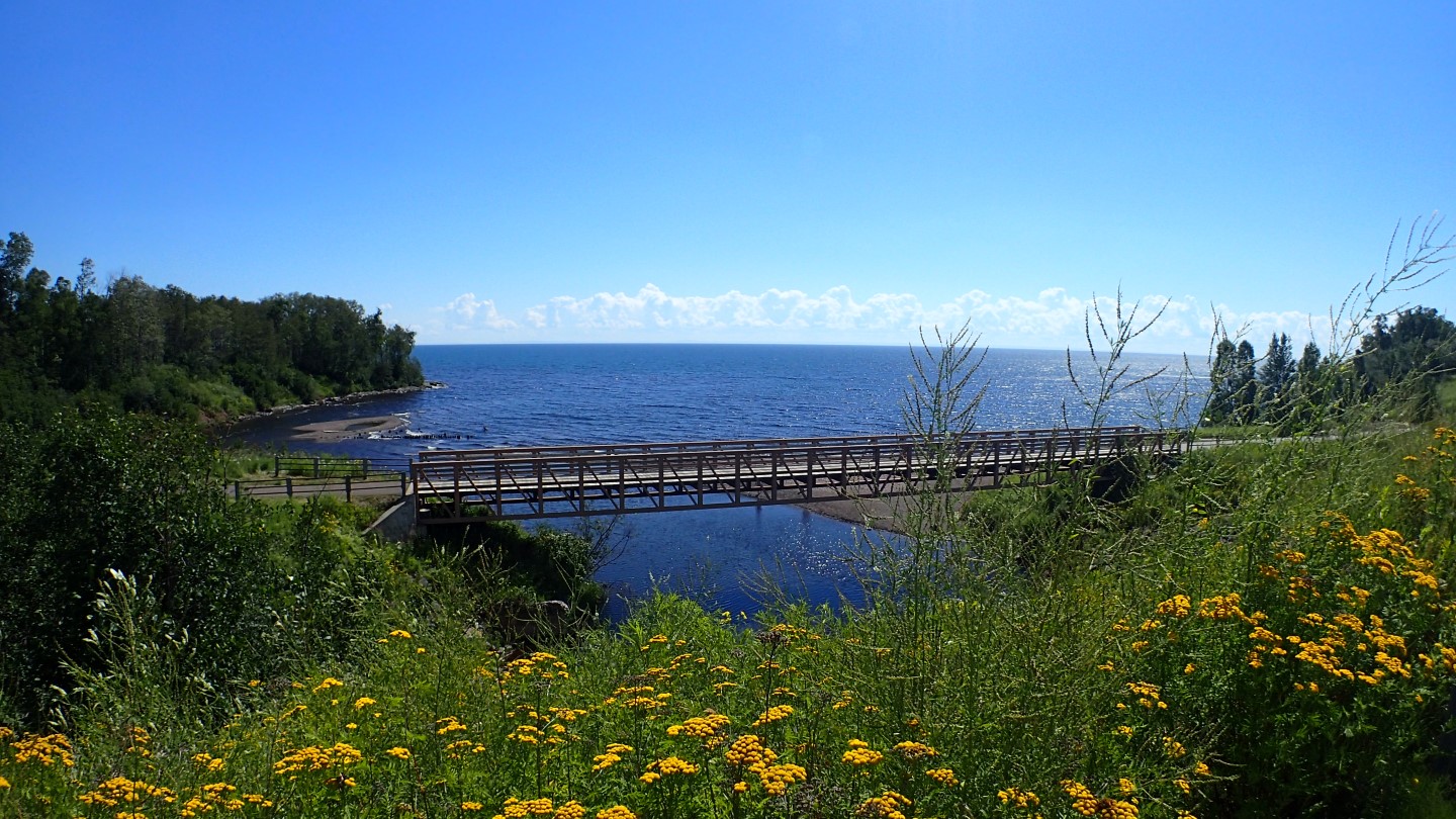
We did manage to find another spot, and so we relocated the coach the morning of the 17th and I took the jeep and headed north to Eagle Mountain. The drive up the shores of Lake Superior was pleasant and offered many scenic views.
One of the many scenic views along the shores of Lake Superior.
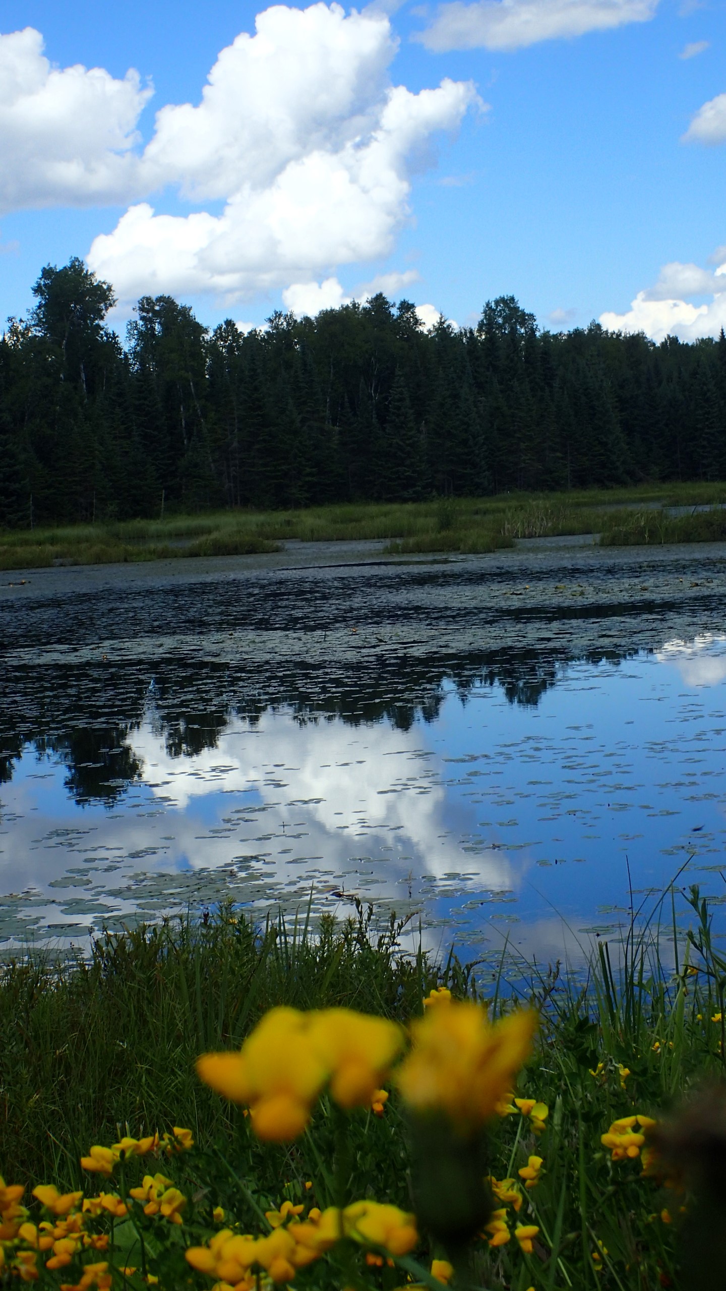
I also found a number of very beautiful settings deep in the woods along the rural road to the trailhead. I was on a schedule, so I didn’t stop for everyone, but I did stop and snap a few photos along the way.
A serene pond I happened upon, just a few miles from the trailhead.
Bad Decisions Make Great Stories
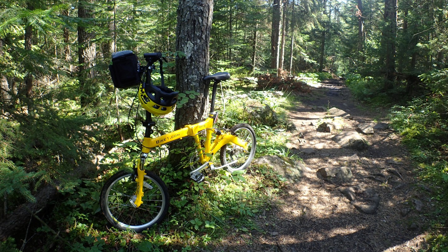
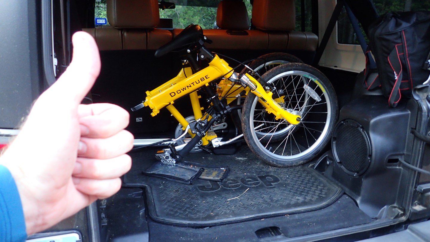
I had one of our DownTube full suspension folding bikes in the back of the Jeep and I’ve ridden it on rough trails before and while it requires a lot of management, it handles pretty well. I’ve been riding for a long time, and have done crazy stuff on my full size Cannondale Jekyll and am not without some skill. I knew the trail was rocky and thought it might be a fun challenge to see how far up the trail I could ride the folder bike. I spoke to different hikers coming down, inquiring about trail conditions, and they unanimously told me it was not possible, which encouraged me. After all, doing the impossible, is my favorite thing!
In the beginning I made great time, and it was loads of fun to fly through the trails leaping and dodging rocks.
Made great time, until I hit the rocky areas.
But then a big drop off at a knarly rock caught the derailer and rendered it inoperable, so I could no longer shift gears. I reluctantly accepted defeat and left the brave little soldier waiting beside the trail to be carried out on my return.
This is as far as the brave little folding bike made it.
I continued on foot, which was always the plan. I knew I would not get all the way to the summit, but I had hoped to get further.
Were I on my full size Cannondale, I could have taken it all the way to the summit, although I would have had to carry it up a few steep and rocky spots. The ride down would have been spirited, but manageable.
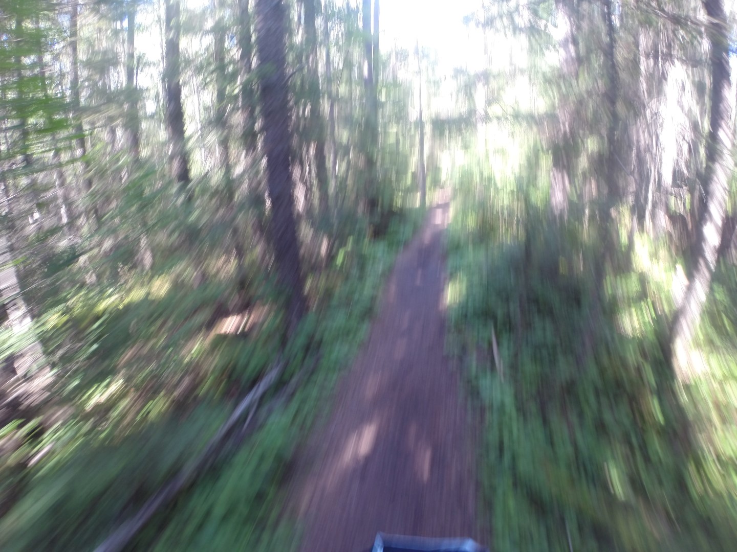
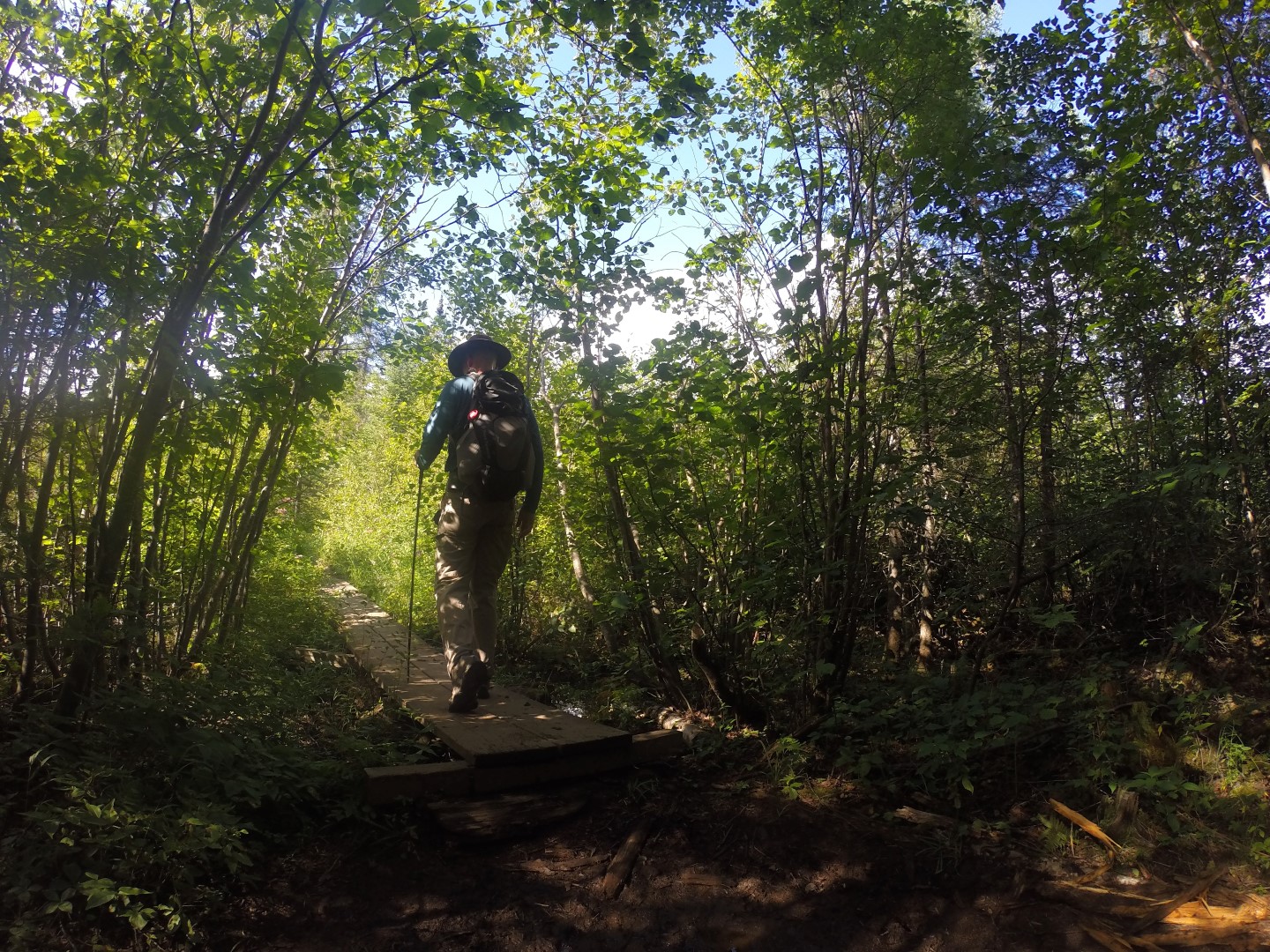
The trail was rocky most of the way, with some fairly smooth sections and a few boardwalks crossing over streams, bogs and especially muddy sections.
There are a few boardwalks passing over boggy areas, but the trail was otherwise solid.
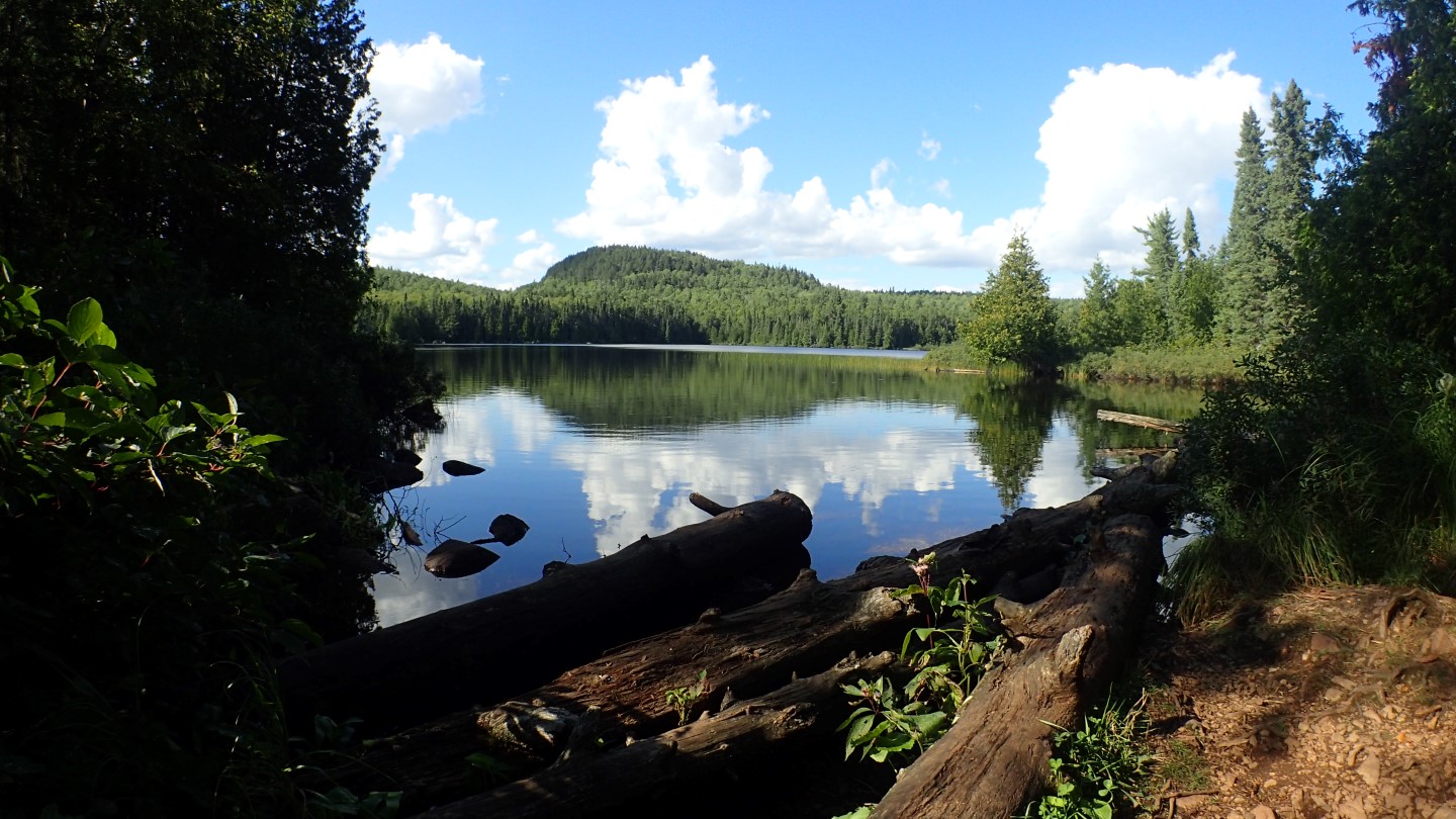
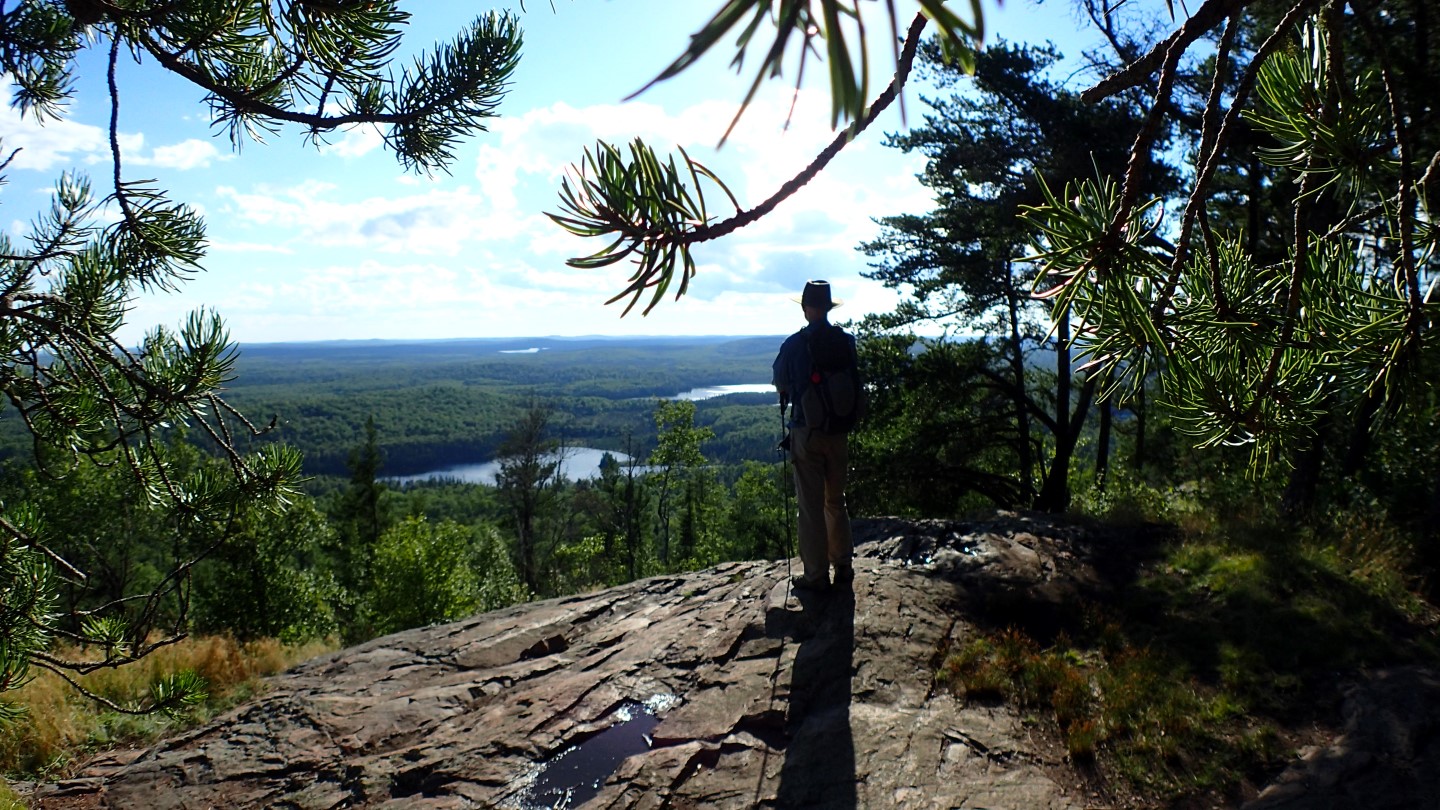
From there I made my way to Whale Lake where I found an inspiring view. After that I began to gain elevation in earnest.
A view from the edge of the becalmed Whale Lake, reflecting the forested hills and skies above like God’s own perfect mirror.
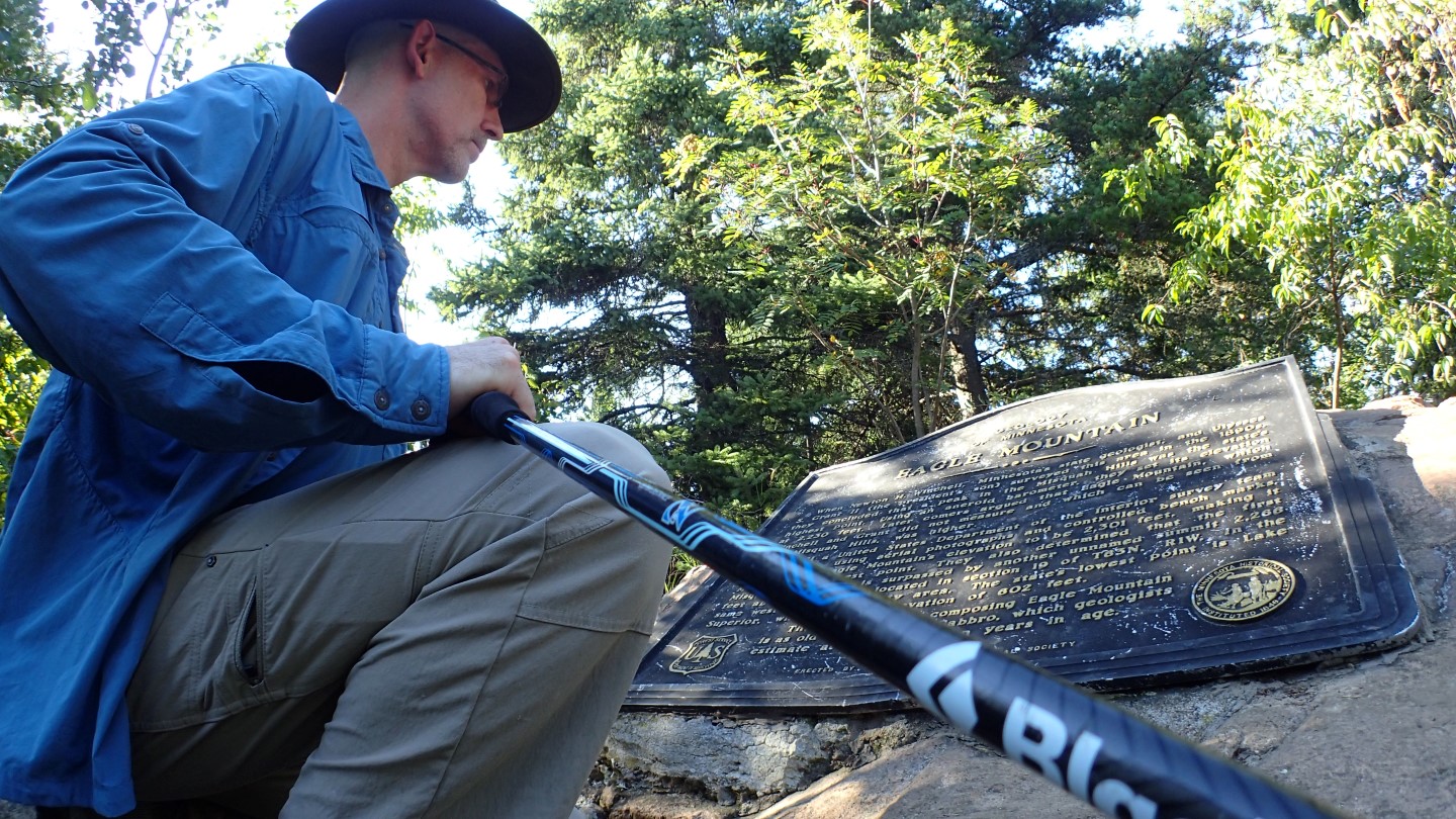
The hike from Whale Lake to the summit, was pleasant although rocky. The trail wound through heavily wooded terrain, with 2 points overlooking the valleys and lakes below. The highpoint itself, was deep in the woods in a small clearing, and was quiet and peaceful, but offered no views.
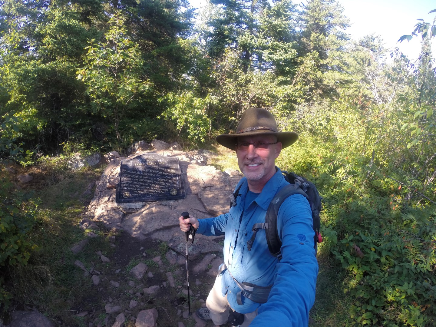
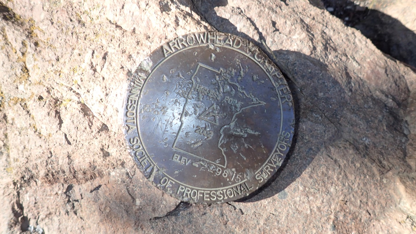
Danger reading the summit plaque.
The summit marker, that officially denotes the highpoint.
I stayed at the highpoint long enough to take it in and snap the requisite photos, but I had in mind to spend some time at the higher of the two scenic overlooks I had passed on the way up. There I took my only break of the day and enjoyed the peanut butter and honey sandwich Susan had prepared for me.
A Classic Mountain Scene
The skies were blue, with just enough clouds to provide some drama. The valley was a carpet of green, punctuated by glimmering lakes. The wind was lazy and the sun was warm on my skin. I spent half an hour soaking in this classic mountain scene. Glorious places like this make it all worthwhile.
A scenic overlook just below the summit afforded magnificent views of the lakes and sprawling forest below.
Wounded Warrior
On the way back down, I began hoping someone had stolen the folding bike so I would not have to carry it out like a wounded soldier. But alas it was still there, waiting beside the trail in silent mockery of my folly.
I managed to repair the bike with a pocket knife, duct tape and a stick. I then rode it out helmeted head held high reclaiming my dignity and restoring my id to its typical state of composed overconfidence.
The folding bike doing what it does best; folded and stowed back in the Jeep.
This concludes highpoint #48 of 50, next stop Michigan!
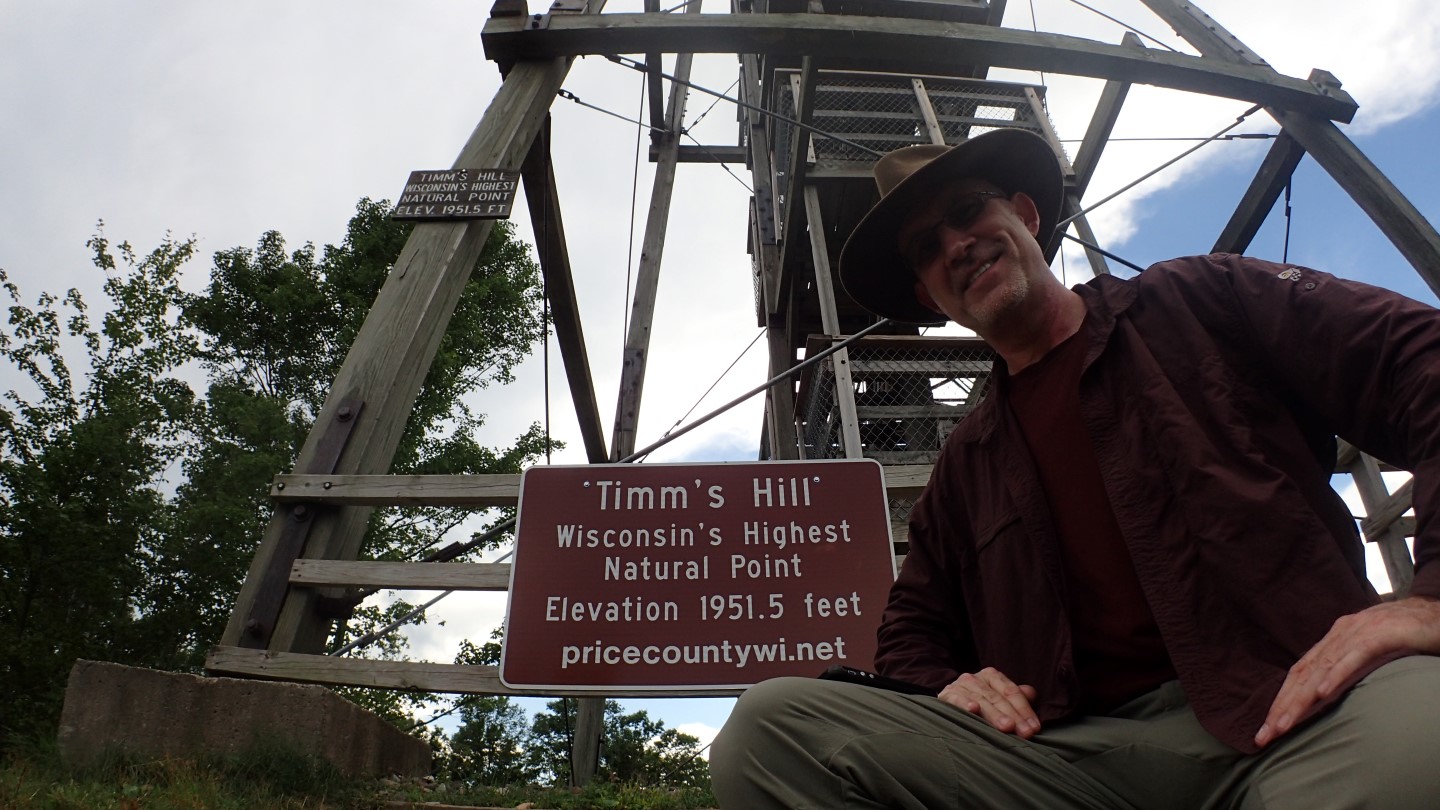
On Tuesday August 16th, 2016, I stood at the Wisconsin high point, Timm’s Hill. It was a beautiful day, and visibility was good. This was state highpoint #47 of 50 for me.
Danger at the natural highpoint of Timm’s Hill, WI
Highpoint Statistics: Summit Date: Tuesday August 16th, 2016
State: Wisconsin
Elevation: 1,951′
US Rank by Height: 39th
Round Trip Hiking Time: 20 Minutes
To view a sortable table of all of the highpoints with completion dates, trip reports, photo galleries, blog entries an GPS tracks, visit the US State Highpoint Progress Page.
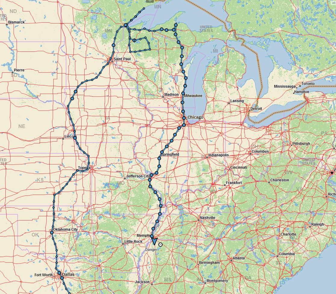
We are 2,900 miles into the trip, and are currently headed home with 500 to go. After leaving Chicago a few days back, we spent a couple of very unproductive days in St Peters Missouri at a beautiful lakeside spot where we whiled away the hours hiking, biking and playing XBOX video games. Hey, you are never too old to be a geek.
Day 14 sees BigByrd 500 miles from home
Chicago Adventures
Chicago was fun as always, and remains one of our favorite cities. We boondocked (this means running fully self contained) a few miles from downtown in a truck marshaling lot that gave us easy access to the heart of the city. As we were pulling in, we saw the cast and filming crew of the Amazon series “Patriot” filming for the show.
So the L’Anse Township is back down to 3,800 and we find ourselves in another Walmart in Manitowoc Wisconsin.
Here’s why; the L’Anse RV Park was all grass you see, and as we were about to turn in for the evening, it began to rain in earnest. We know from experience that a 32,000 lb. bus on wet ground is bad juju. So we pulled up stakes and made an emergency exit, and once I got on the road, I felt like driving so I drove another 5 hours while Susan slept. We are now only 2 1/2 hours from Chicago where we plan to spend a day or two on our way back to Texas.
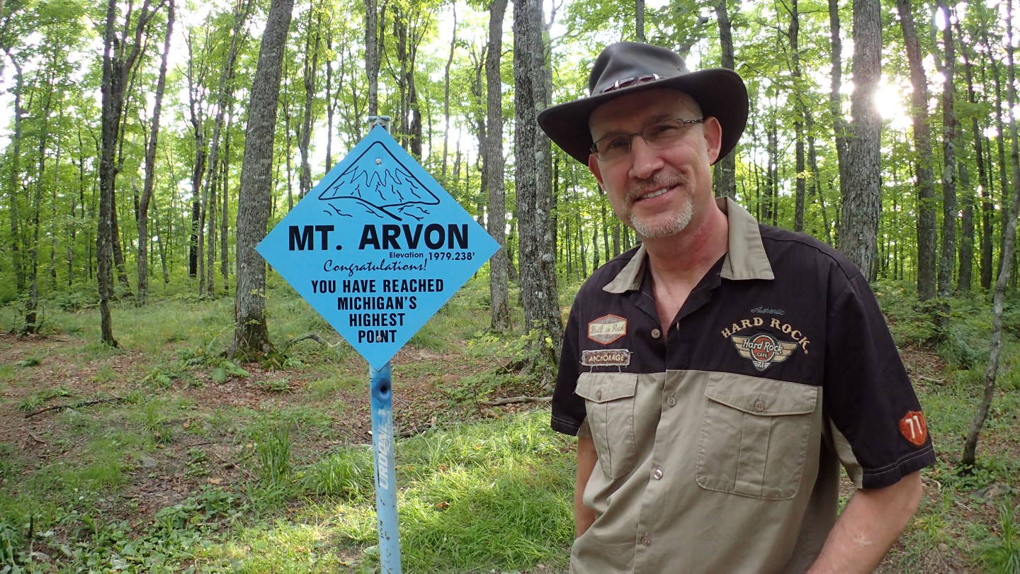
State #49 is complete! We are standing on Mt Arvon’s peak. Getting here on the treacherous roads was quite an adventurous endeavor, that required a 4×4.
For the next couple of nights, we’ll be calling the L’Anse Township, MI population 3,800 home, so now it’s 3,802. We are parked next to a scenic lake and the sun will be setting across it, unfortunately we won’t see it tonight as we are in the Jeep making the 2 hour round trip to Mt Arvon the Michigan highpoint.
It’s a easy one mile hike so no difficulty there. Our biggest challenge will be navigating the miles of surprisingly rough logging roads between here and there. I almost bought a Prius, glad I manned up and bought the Jeep instead…
Managed to repair the bike with a pocket knife, duck tape and a stick. Rode it out with my head held high! Back at the trailhead and mission accomplished!
Taking break on a cliff just below the summit with sweeping views of the forested valley below, punctuated by glimmering lakes. Its a classic mountain scene
On Eagle Mountain summit, it’s heavily wooded, & peaceful. Clear skies above w gentle winds. Perfect day to stand on a mountaintop, beat my chest & yodel.
Bike was officially a bad idea. Big drop off a boulder tore off the shift derailer. Bike is down, but I soldier on. Yes, I know I’m stubborn, what of it…
Pretty drive up the Lake Superior coast & no sinkholes today. At trailhead & I’m going to ride the bike. I’ve been told it’s not possible, which is appealing
The schedule change yesterday meant that we needed to stay in Duluth another day for me to do Eagle Mountain the Minnesota highpoint.
The problem is that a couple hundred thousand people are now flooding into Duluth and every RV park within a hundred miles is booked. We heard from a local that the convention center allowed RV parking, and managed to get the only spot large enough to accommodate our 41′ coach. So the coach is parked, and I’m headed north now for Eagle Mountain. This will be a long day as I expect 6+ hours of driving and around 5 hours of climbing.
Sinkhole circumnavigated, trailhead found. Standing on Timm’s Hill Wisconsins highpoint. Theres a tall tower with unobstructed view over trees, peaceful here
As Napoleon famously said, no plan survives contact with the enemy, and so it is with highpoints.
I was planning on doing Eagle Mountain the Minnesota highpoint today, but heavy rains rolled in last night dumping lots of water on the highpoint as well as Duluth, and continued thunderstorms are forecasted today. If I didn’t have another option, I would go ahead and do Minnesota, but since I’m within striking distance of Wisconsin, I’m going to head for that one instead. It is a 7 hour round trip drive without stops, but a much shorter 1/2 hour hike and its dry there, at least for now.
I’ll try for the 6 mile Eagle Mountain climb tomorrow, and I expect it to be a muddy bog.