28
Oct
inReach message from Robert Danger Byrd
Taking a break at Williams Lake which of course is frozen. Calm here & I could fly drone, but think I’ll save battery power for higher up, my 4 packs =1 hour

Taking a break at Williams Lake which of course is frozen. Calm here & I could fly drone, but think I’ll save battery power for higher up, my 4 packs =1 hour
It’s just below freezing and calm. Surprised to
see snow down this
low. Brought extra layers in case I get nailed down by a storm. Leaving the trailhead now
Had a hearty breakfast of oatmeal and homemade organic muffins Susan made yesterday. She also baked some organic bread and made me some peanut butter and jelly sandwiches this morning.
We are leaving the RV now and since we are close and I’m taking a different route down, Susan is going to drop me at one trail and pick me up at another.
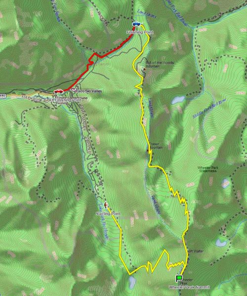
So this is the route plan. The yellow path is the route from the starting point marked by the hiker and it takes me up the more challenging Williams Lake Route route and then after reaching the summit, I’ll continue North up the ridge along the more scenic Bull of the Woods route for just over 8 miles. The blue truck is where Susan will pick me up, provided she can get up those mountain roads.
We will communicate via the satellite beacon, and if she cannot make it, I will continue down to the alternate pickup for an additional 2 miles to the point marked by the red car.
As always, you can follow along real time on the map on the Adventure Map. I have marked these routes and waypoints on the Adventure Map as well.
We rolled into Taos New Mexico Sunday, and it is truly a magical place with vast prairies, mountains and incredibly colorful sunsets.
Taos New Mexico is spacious and dramatic
Weather Flip Flop
I’ve been watching the weather as there have been some snow storms on the mountain, and while I dig extreme conditions, it makes photography challenging especially since I plan to carry a flying camera up the mountain. The weather report predicted a perfect day tomorrow and some weather today. As it turns out, today was the perfect day, and tomorrow is now calling for weather. I’m going for it tomorrow anyway, and if I don’t make it, I’ll try again Thursday or Friday.
Drone
Been getting comfortable with the new Solo photography drone, and it’s going to be a great tool.
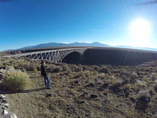
Danger flying his 3DR Solo photography drone at the Rio Grande River Gorge Bridge
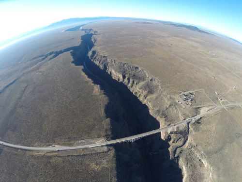
An aerial photo of the awesome Rio Grand Gorge from waaay up
I love being able to suspend a camera in mid-air anywhere I want, it’s quite exhilerating and I intend to put it to good use.

A drone photo from down inside the Rio Grande River Gorge
Wheeler Plan of Attack
I’ll be on the mountain early and will be posting from the satellite beacon as usual. Some people split this one into 2 days, but I’m going to do it in one. It is going to be a full day as its a big climb with a 4,500′ elevation gain and I’m traveling heavy with the drone and supporting equipment. My plan is the go up the shorter but steeper, more technical route on the way up, and take the longer more scenic route on the way down.
Passed into the Land Of Enchantment half an hour ago and many large and juicy bugs had to die to get us here. Next stop, Albuquerque New Mexico, and yes I had to rely on the spell checker for that one. We will head north from there on our way to Wheeler Peak which at 13,161’ is the state highpoint of New Mexico.
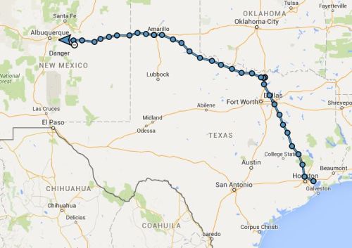
BigByrd
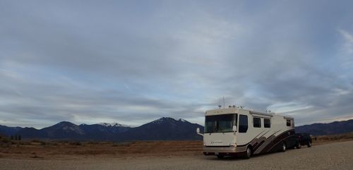
Once again, we are traveling in our remodeled 41’ motor coach we lovingly call “BigByrd”. The new 200 Amp computer controlled alternator is performing flawlessly, however the 4 year old house batteries are weak, so I bridged the house bank with the chassis bank again to steal power. Before the next trip, I plan to convert to one large AGM bank which will eliminate battery maintenance which I despise and boost us from 450 Ah to 900 Ah (able to pull 900 amps DC current for a full hour).
It really pays to have a chauffeur, as I’m able to get quite a bit of work done. It’s not cheap though, this one I have to buy expensive cars, clothes and jewelry.
A 72 Ounce Steak
Last night we stayed in Amarillo Texas, and obviously we dined at the Big Texan Steak Ranch home of the 72 Oz Steak challenge. It costs $72 dollars, but if you can eat it in one hour, it’s free. I was going to take the challenge, but Susan exercised her veto powers. I was in the mood to do something totally out of control, so I bought some fudge instead.
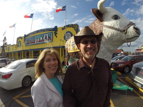
Let’s go have some steak!
The Big Texan is a Texas institution and there is a lot of interesting history here. The original Big Texan was opened in 1960, along Route 66 by R. J. “Bob” Lee. The towering sign of a long-legged cowboy that Bob erected next to the building became a distinct landmark on Route 66. The steak challenge began in the early years and became wildly successful as a marketing campaign. Even if you yourself have not been here, you have probably heard of the Big Texan.
In the early 1970s, Interstate Highway 40 replaced Route 66 as the major traffic lane so Bob Lee purchased land along the route for the new highway and built a bigger and better Big Texan Steak Ranch along I-40. The iconic giant cowboy, was moved by helicopter from its original location to the new restaurant where he stands long, tall and proud today.
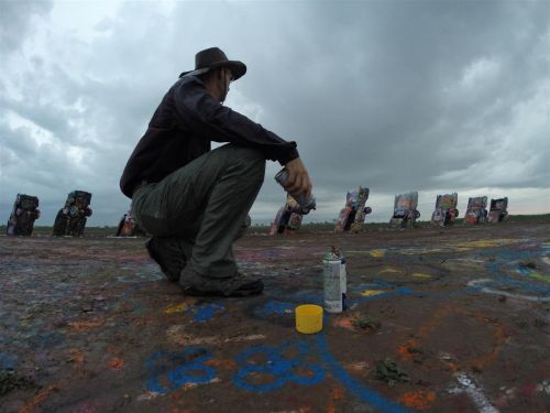
Cadillac Ranch & Crashing Drones
We originally were going to head straight up to Taos from Amarillo, but are diverting to Albuquerque to get some parts for my photography drone which I crashed while trying to shoot some sunset footage of Cadillac Ranch. It was of course totally Susan’s fault.
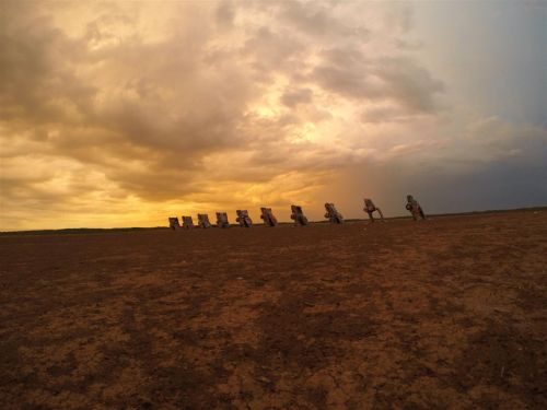
Last I was at Cadillac Ranch in 2014 was during sunrise with a storm approaching
If you have never stopped by Cadillac Ranch, you are missing out on another interesting bit of Texas history. It’s a series of Cadillac’s representing the major line changes buried nose down. It was conceived by Chip Lord, Hudson Marquez and Doug Michels and funded by Stanley Marsh III an eccentric Texas oil man. The cars are completely stripped now, but most were running when it was originally installed. Today they are covered in a layers of graffiti several inches thick, which grows every year. Interesting side note, the cars are buried at the same angle of the Great Pyramid of Giza in Egypt.
Another photo I shot the last time we passed through Amarillo during the Oklahoma highpoint trip
Sources:
https://en.wikipedia.org/wiki/Cadillac_Ranch
http://bigtexan.com