Mt Katahdin Trip Report
Mt Katahdin was highpoint #8 of 8 and the crown jewel of our 2014 Northeast trip. Susan did the first 7 with me and my good friend and climbing partner Rick Overholt joined me for Katahdin.
Summit Date: Sunday October 10th 2014
State: Maine
Elevation: 5,268′
Distance: 10.4 Miles
Katahdin is located in Baxter State Park and is the Northern terminus for the Appalachian Trail as well as the highest mountain in the state of Maine. Rick had climbed Mt Katahdin before, but wanted wanted to do the more technically challenging Knife Edge route, and wanted to do it in the Fall during high color. High color is typically late September to early October so that is when we planned our trip. The park closes mid October as the weather begins to get ugly, so the limited campsites are booked well in advance.
The Original Plan
Since Rick was familiar with the park, I asked him to make the arrangements! So he reserved a lean 2 at the Katahdin Springs site which is at the trailhead. This would have us approaching the mountain from the west on the Hunts Peak trail which merges with the Appalachian Trail. This is a very scenic route, and was the route Rick took last time he summited this mountain. However the Knife is on the opposite side of the summit which meant we would summit, go across the knife, come back up to the summit and then go back down the Hints Peak trail.
Day 1 October 9th
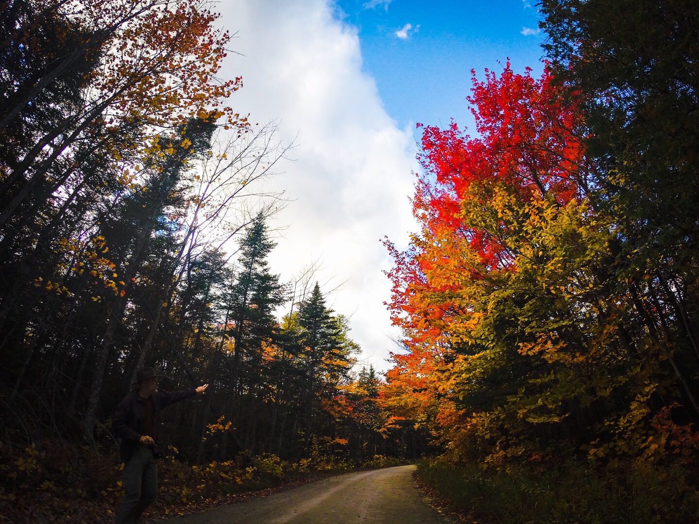
We made the 2.5 hour drive from Marriott Courtyard in Bangor Maine to Baxter State Park. The trees were approaching high color and we thoroughly enjoyed the beautiful drive.
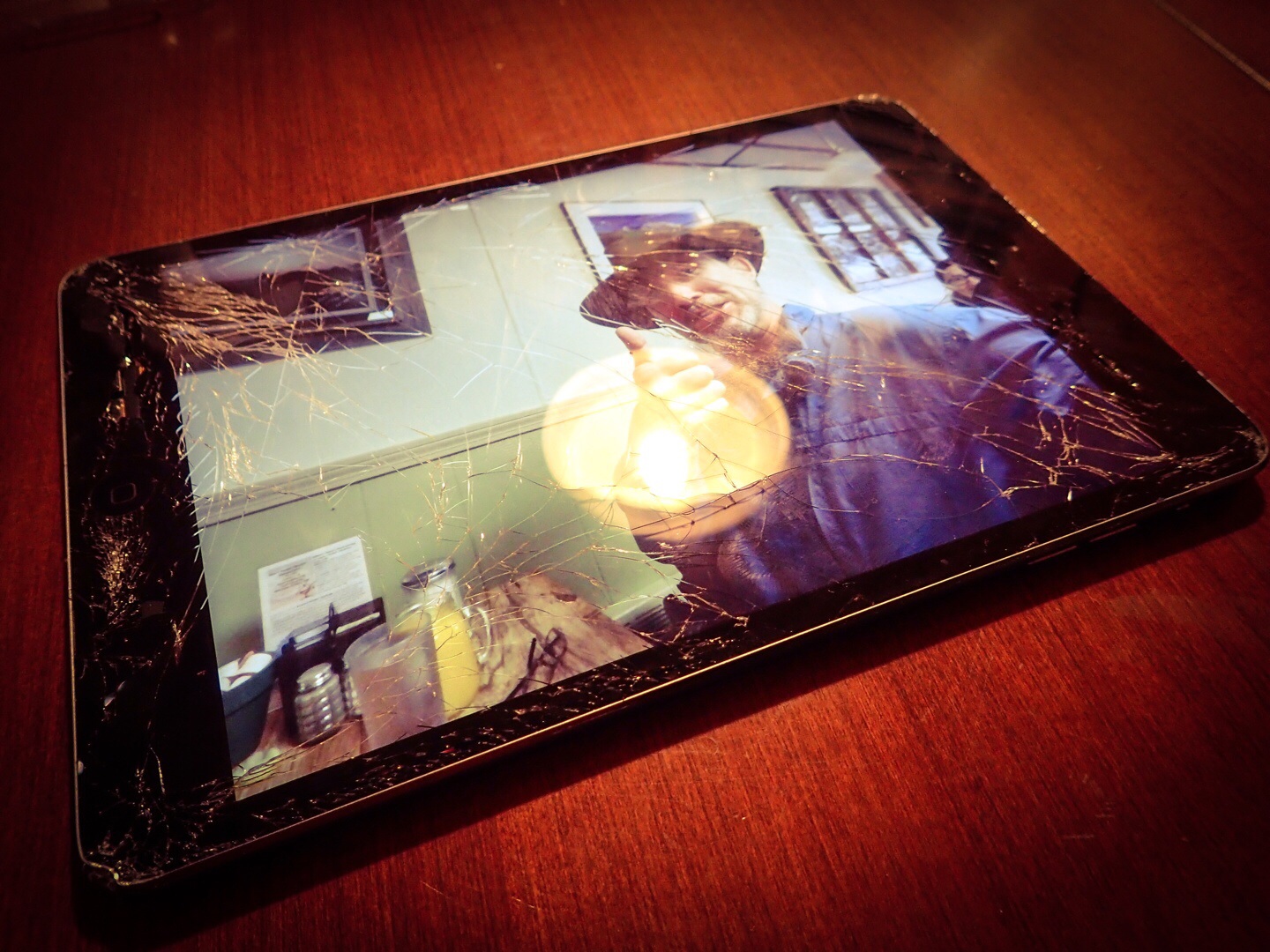
Caution! Flying iPads
The cell coverage is generally poor here, so I had my iPad Mini propped up on the corner of the dash to get a better signal. At one point we crossed a photogenic bridge spanning a lazy river. As I hurriedly rolled down the window to snap a photo, my iPad Mini was sucked out the window and over the bridge railing. I have AppleCare but it does not cover loss, so I was hoping for recovery. The bridge was long and narrow with no place to park, so we had to cross it, then turn around to get back to it. I found the iPad itself balanced precariously on the edge of the bridge, but the leather Smart Cover was nowhere to be found. Surprisingly it still works fine despite the grotesquely shattered screen. I wrote this post on the plane using it, although it does give me a headache after a while. I think the people sitting around me fell sorry for me as I’m getting some very sympathetic looks.
A New Plan
Back to the timeline; When we arrived at the park, we spoke to the ranger at the visitors center and learned that the Knife Edge was best approached from the opposite side and that they just so happened to have a cancellation that opened up a lean 2 site at Chimney Pond which would put us much closer to the base of the mountain. From there we could take the Knife Edge route (weather permitting) up the mountain and come down the Saddle Trail which would keep things interesting.
Pack it Again Sam
Our original plan was to camp right off the trailhead, so we came heavy with, charcoal, a cooler full of meats, cheeses and other fare. We had to scrap our original plan as the new Chimney Pond site, was a few hours hike. Now that we were hiking everything in we had to completely reorganize and repack our gear. We left a lot of stuff behind, but had small packs, so it was a challenge to get the essential gear shoehorned in. My pack was stuffed tighter than a ripe sausage and I had a bear of a time zipping it. Rick had so much stuff hanging off the outside of his even smaller pack he looked like a prospector.
The Hike to Chimney Pond
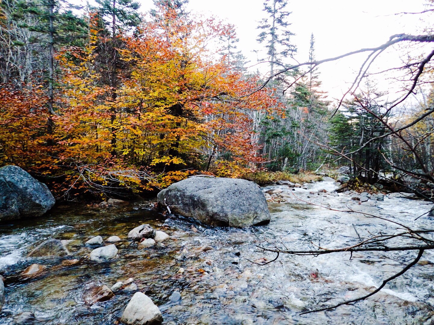
The hike in to Chimney Pond was very pleasant and the weather was perfect. We found the trail to be well marked and maintained. There were several log bridges over water crossings and bogs as well as some impressive and well constructed foot bridges over particularly wide gorges.
As the sun dropped behind the mountains, darkness rapidly descended upon us. About this time, we came to a point where the trail went across a meandering river that required us to make long leaps from stone to stone. It would have been difficult in broad daylight, and was especially challenging in the dark. After a few minutes of this, we found ourselves standing on large stones surrounded by rushing way in the dark with no idea which way to go. After donning our headlamps, I started studying the GPS map. About this time we saw some headlamps bobbing past some distance away which told us where the trail was and we were well off of it. After that it was smooth sailing over well marked trails all the way to Chimney Pond. The temperature continued to drop, and dipped just below freezing about the time we arrived and the wind began to blow. Our home for the evening was a 3 sided lean 2 so once we stopped moving it was quite cold.
Buddy Can You Spare Some Fuel?
Once we began unpacking we realized we had forgotten the cooking fuel, which punched a big gnarly hole in our meal plan. We both had a fuel canister to begin with, but agreed we only needed one. We each thought the other was going to carry fuel and tossed ours out. No matter, I am very experienced at mountain begging, and visited the various groups around the campsite eventually finding fuel. While we were out fuel begging, it began to sleet so we donned our hard shells and kept on panhandling. At any rate, the crisis was averted and we had a hot meal of chicken teriyaki and fried sausage. Rick ruined my Titanium pan in the process, apparently those things are not made for frying sausage.
Later that evening the temperature dropped further and wind began to blow much harder, fortunately I had brought my heaviest Montbell Down bag and was toasty warm despite our shelter lacking a wall. I also had 2 layers of clothing including double socks. I had considered bringing a summer bag as the weather was expected to be much warmer, but I’m glad I didn’t. I like Rick a lot, but not enough to share a sleeping bag with him.
Summit Day! October 10th
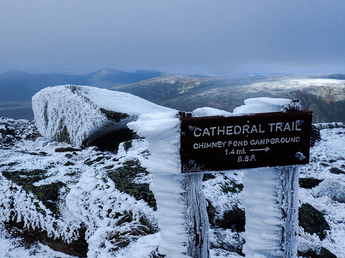
When we woke, the temperature was still hovering just below freezing, and it was still pretty windy although not as windy as it had been during the night. We were warned that the Knife had been icing up the last few mornings, which makes the smooth rocks treacherous. We checked with the park ranger station at Chimney Pond and they confirmed it was iced over so we could not go up that way, same story with the Cathedral route which involves a lot of classic rock climbing up large smooth sections of rock wall. As we approached the mountain, we could see the ice. So we took the saddle route instead and would descend via the knife if the ice melted. The upper mountain was also shrouded in a heavy fog which we ascended into severely limiting visibility. We also encountered some ice on the way up, but not enough to be problematic.
As we climbed higher the mercury continued to drop which felt great on the leeward side of the ridge. But once we cleared the saddle ridge we were blasted with 35-40MPH winds and temperatures in the mid twenties. With windchill it was well down in the teens. I had on 4 layers of technical clothing and still felt the biting cold. The only thing I could do was move faster to generate more body heat which helped.
The mountaintop was a dark foggy landscape of gray stone covered with a layer of rhyme ice. The low visibility made us feel isolated, but we knew where to go and kept moving. As we climbed higher up the saddle ridge the wind slowed making it bearable, but the fog only intensified as we climbed higher.
Kowabunga Dude! You Made The Summit!
As is often the case with mountains, the summit was a very cold and windy place and the fog was much thicker here limiting visibility to 30′ or less.
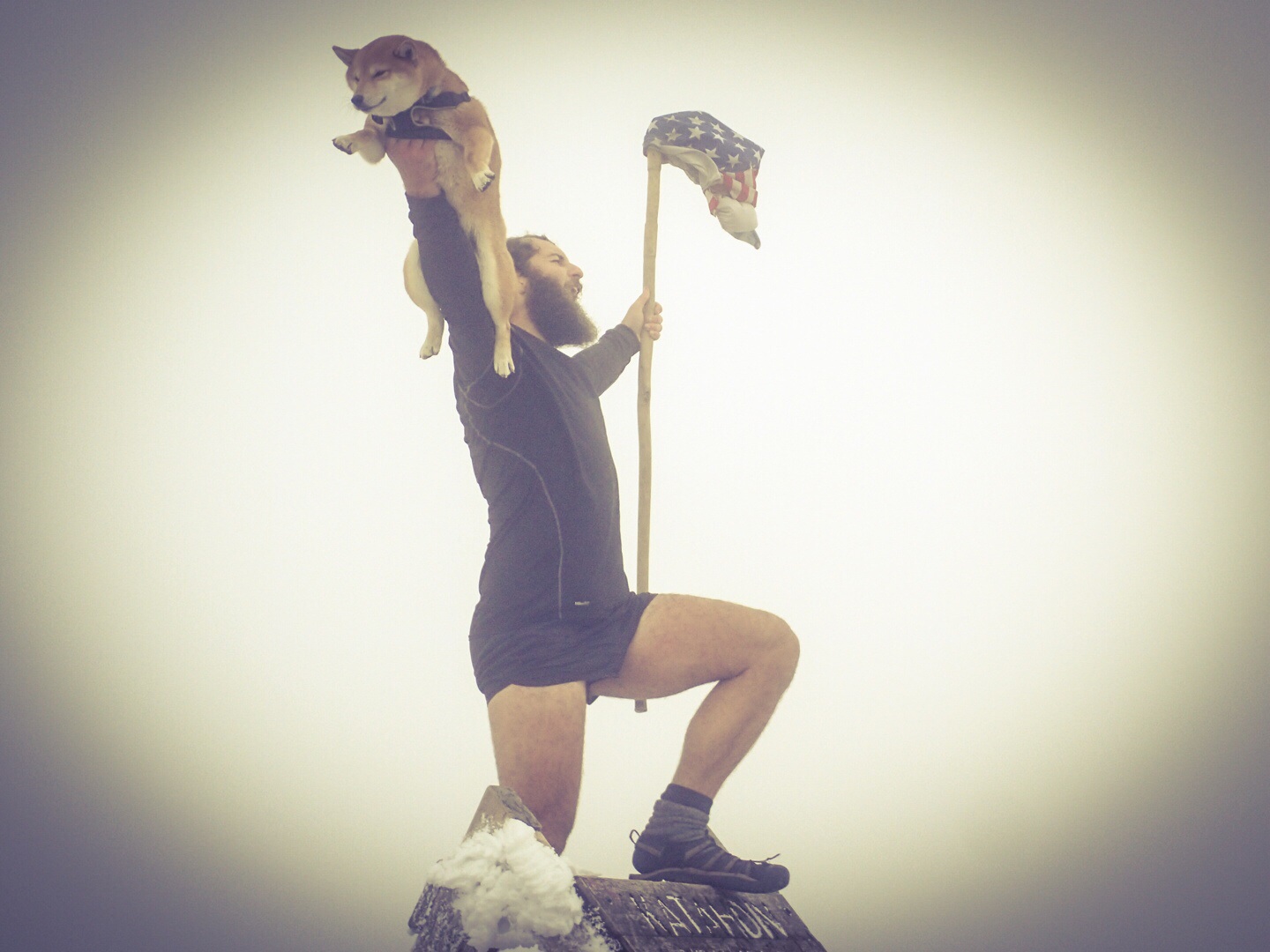
There was a lot of traffic on the mountain most of whom were through hikers completing the 3,000 mile Appalachian Trail which ends at this very Summit. They were a very colorful crowd and had some interesting ideas about summit photos. Some had flags, others had pizza and beer. One fellow stripped down to his underwear and thrust a dog into the air while yelling, “Kowabunga Dude!”
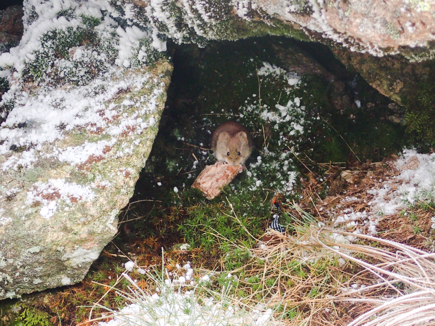
Another who went by the nickname , “The Governor” donned a smartly pressed suit complete with white shirt and tie for his summit photo. So we found a big rock to hide from the wind behind and enjoyed the show while we waited to take our own summit photos. While we waited, we ate some #GrabTheGold bars and made friends with a mouse.
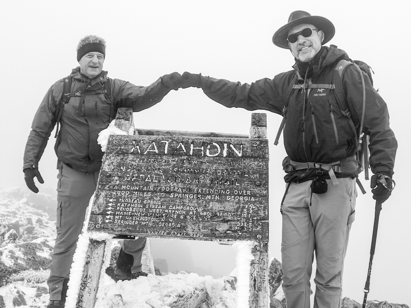
The summit was fogged in so no beautiful backdrop. And not being in the mood to strip to our skivvies and nor having the foresight to bring a freshly pressed suit or a dog, we just took regular summit photos and headed down. I did shoot a black and white, now doesn’t that look classic?
All in all it was one of the more unusual summit experiences I have had.
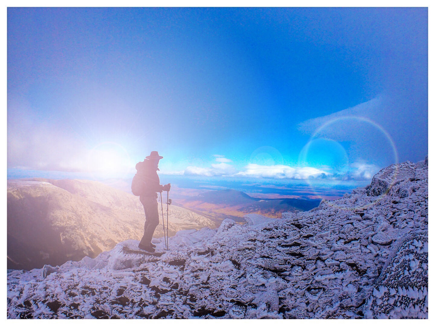
The Fog Lifts!
The weather on the summit was still pretty bad, and the Knife Edge would be even worse, so we didn’t even bother looking at it, and came back down the saddle. As we approached the saddle ridge the fog began to lift and we were treated to a very interesting contrast in scenery. We were standing in an icy wasteland looking down on blue skies and colorful valleys. It was quite inspiring and we were both awestruck. We took our time coming down enjoying the magnificent view as long as possible.
As we descended it began to warm and the ice above began melting turning our trail into an active stream. We had to pay extra attention to our footing as we worked our way down the now slippery rocks.
The Lower Mountain
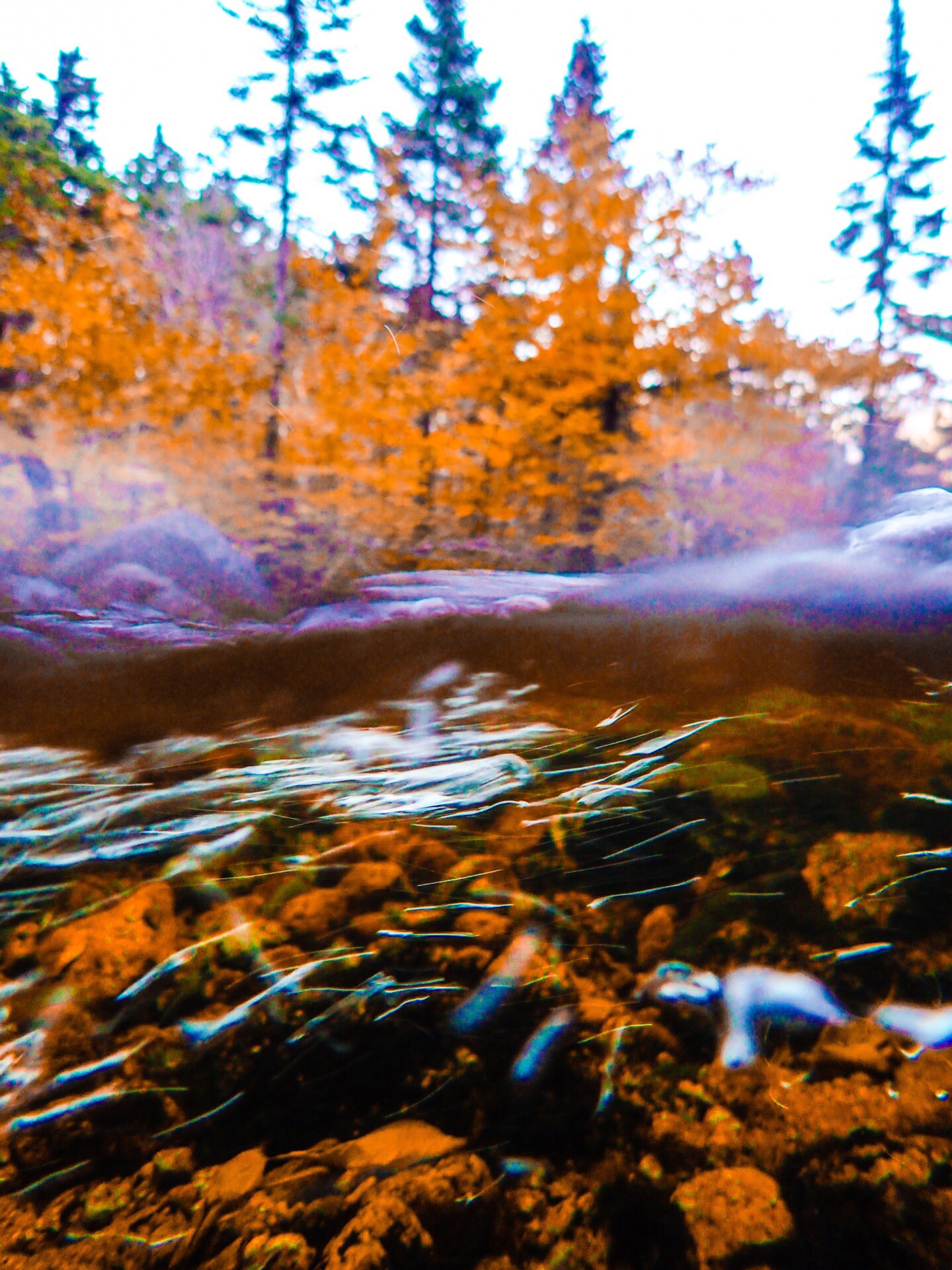
The hike back through the lower mountain valley was more beautiful as we still had daylight and the colors had deepened. In fact, it was the most beautiful woodland trail I have ever hiked. The trail went beside, over and through mountain streams and rivers and the trees were magnificent in their fall splendor. Rick says the other side along the hunt trail is even more spectacular.
New Digs
Our second night was still booked in a lean 2 at Katahdin Streams on the other side of the mountain, but on the way down we encountered a park ranger and asked him if there were any cancellations (many folks cancel in fowl weather) on this side of the mountain. He used his radio and turns out there was room in the trailhead bunkhouse which is a cabin that sleeps 8 and even has a wood burning stove. This meant that we needed to hike all the way out, but considering that we had a feast waiting at the trailhead we decided to go for it and were glad we did.
Once we made it back to the trailhead we immediately began cooking filets. We had a fantastic dinner and met some interesting young men who were also in the bunkhouse. We had a good long sleep and got up late the next morning as is expected when you climb a mountain.
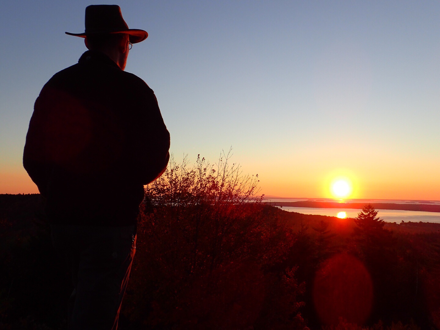
Point Lookout Resort
So the rest of the adventure was securing a hotel room. Due to the fall colors this areas is known for, there was not a single solitary room available in Bangor Maine. We had to drive all the way to the coast to find a room, or cabin in this case at the Point Lookout Resort. The cabin was very well appointed and served us well.
The next morning we got up before sunrise and went up to the lookout point the place is named for. Then we broke out the last of our provisions and had breakfast while waiting for the sunrise. I brought some fine cigars which I had planned to smoke at the summit, but it was too windy so we smoked them here while watching a beautiful sunrise over the east coast. We would have been some of the first people in America to see it and it was a fine way to wrap up this trip.